


7 top hikes in Kyoto for scenic views and cultural encounters
Forested paths wind through the stunning mountain ranges that surround Kyoto, calling out to walkers. Here are our favorite hikes in and around Kyoto.

Visitors are lured to Kyoto by its rich history as the ancient capital of Japan, but nature lovers come here for the hiking trails – both well-trodden and off-the-beaten-path – that snake across Kyoto Prefecture, providing a very different experience of this historic corner of Japan.
When you're done exploring the sights in the city, forested paths weave through the stunning mountain ranges that surround Kyoto on three sides, providing a perfect excuse for a soothing and relaxing day trip away from the city bustle.
Though the list of hikes in the region around Kyoto is almost limitless, the following trails provide some of the most spectacular views in the prefecture.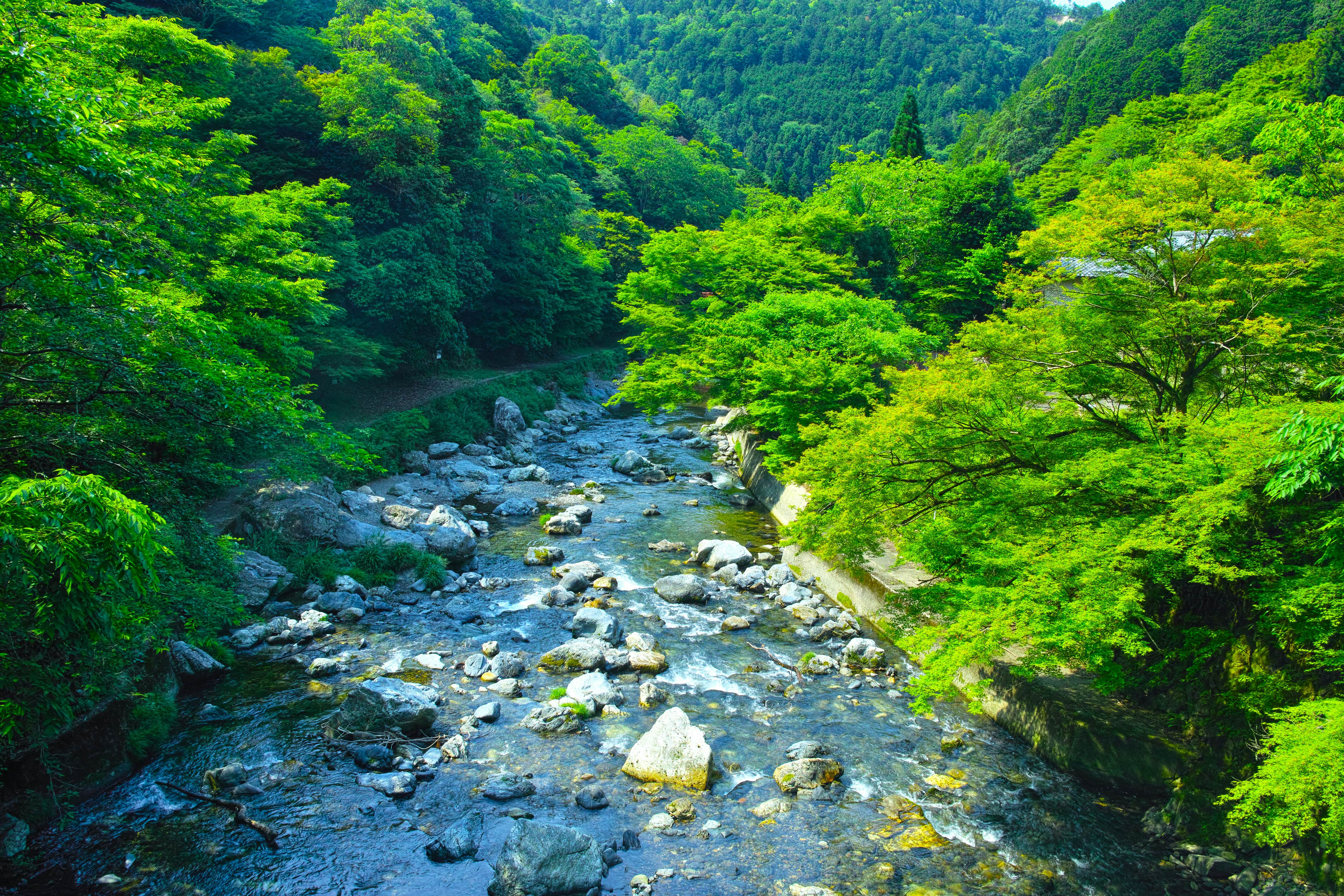
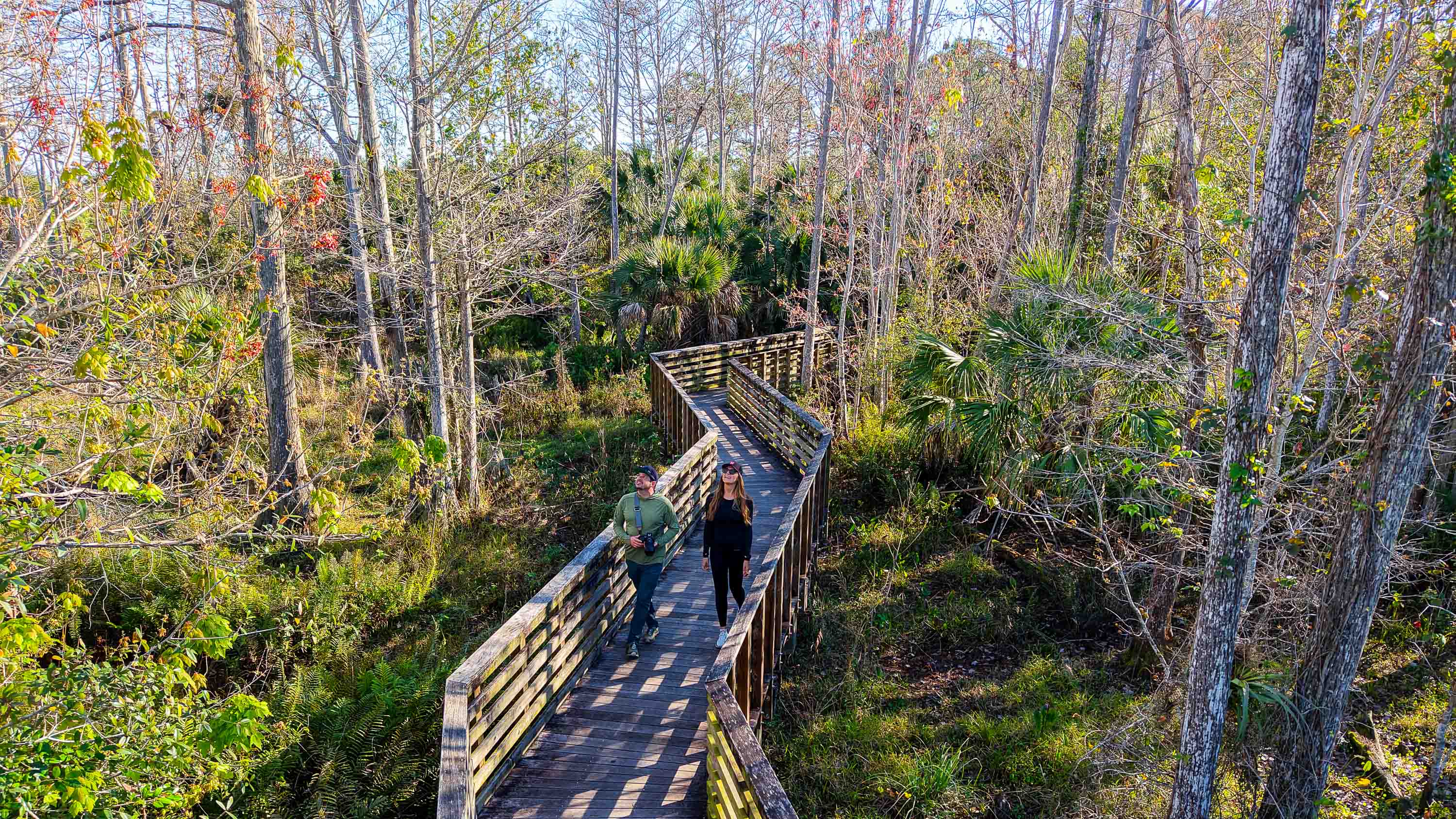
1. Takao to Hozukyō along the Kiyotaki River
Best hike for picnicking
11km (7 miles) one way, 4–6 hours, easy to moderate
This highly enjoyable walk combines atmospheric temples, a charming river and an atmospheric waterfall, making for an enchanting day out from Kyoto. To access the trail, take a bus towards Takao and alight at Yamashirotakao, then head down to the river following the steps marked with a sign saying "Hiking Course."
Before you set off on the hike itself, it's worth stopping by the Saimyō-ji and Jingo-ji temples. These rural, mountainside shrines have beautiful grounds to explore and are far less busy than the famous temples in the city center.
When you're ready, follow the trail along the banks of the Kiyotaki River. It's a pleasant route that meanders beside emerald waters through a valley surrounded by forested mountains. About halfway along, you'll come across an area with wide gravel banks and picnic tables that makes an ideal picnic spot.
Once you are fueled up, you can take a detour to the Kuya-no-Taki waterfall. Hidden deep in the forest, this is an especially atmospheric part of the hike that takes you past abandoned shrine buildings and through a torii (ceremonial gate) to reach a tinkling, mossy cascade.
Back on the main path, head down to Kiyotaki village and you'll pass the start of the trail that leads up Mt Atago. Continue to follow the river across bridges and through tunnels until you join the road that takes you to Hozukyō Station; from here, it's a 20-minute train ride back to Kyoto Station.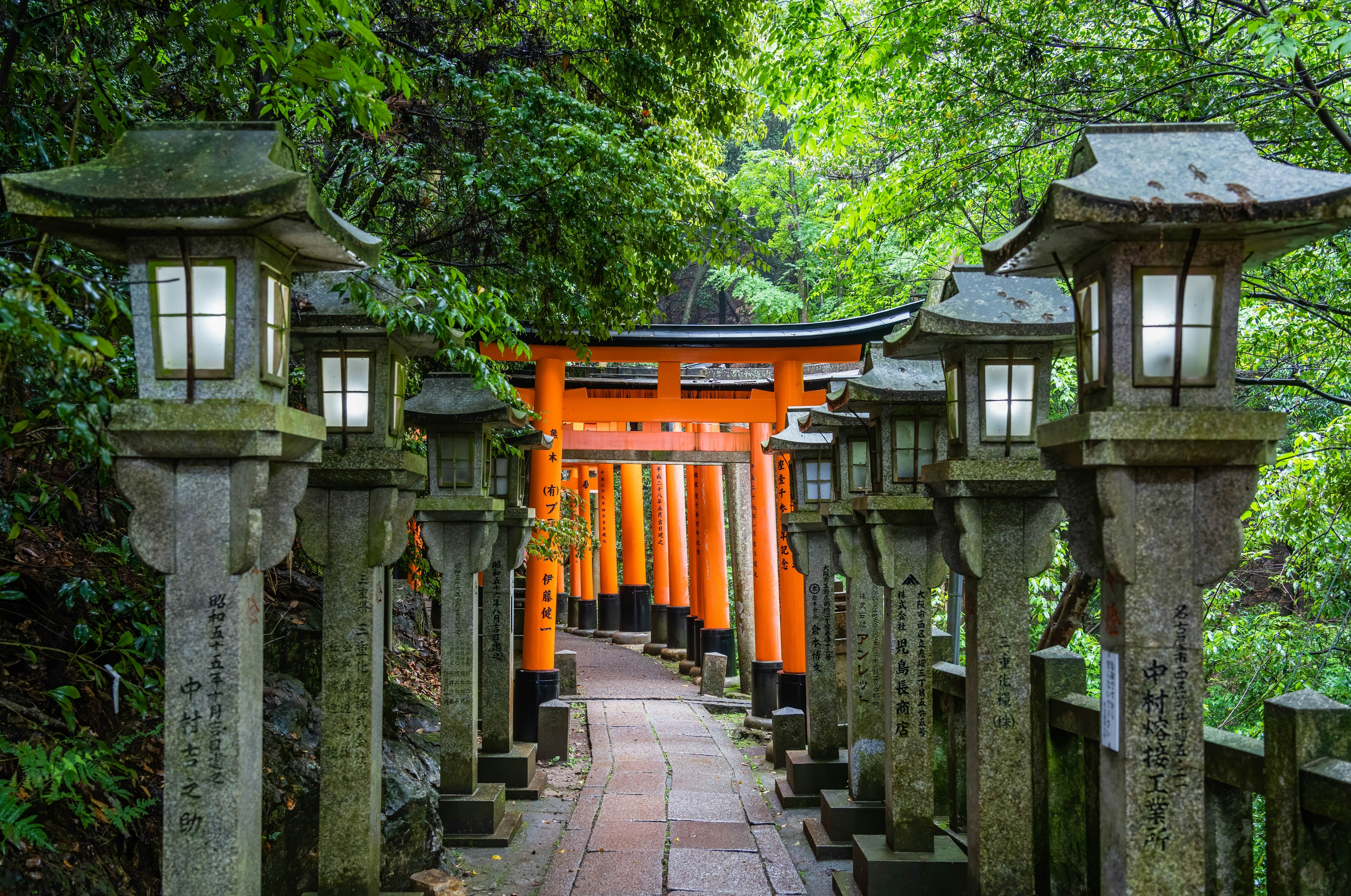
2. Fushimi Inari pilgrim circuit
Best hike for mesmerizing photos
5km (3 miles) round trip, 3 hours, easy to moderate
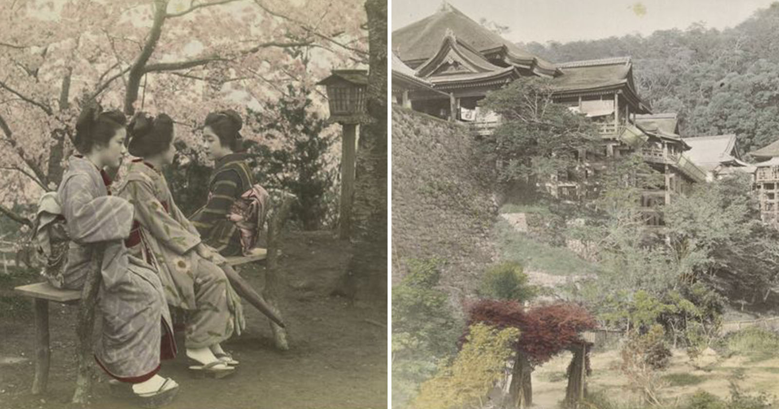
One of Kyoto's most iconic shrines, ancient Fushimi Inari-Taisha lies at the southern end of the city. It's the most revered of the thousands of shrines around Japan dedicated to Inari, the Shinto god of rice. Foxes are thought to be Inari's messengers, which explains the many fox statues scattered across the shrine grounds.
Fushimi Inari-Taisha is famous for the 10,000 vermilion torii gates snaking around 233m-high (765ft) Mt Inari. Most tourists walk along the first section to snap some Instagram shots, before turning around and heading to the surrounding souvenir shops, but the best way to get the full Fushimi Inari experience is to hike all the way around the peak, soaking up the unique atmosphere.
The hiking route begins behind the shrine's main buildings and continues up the mountain's wooded slopes. Shrines, shops and eateries dot the trail, so you'll have plenty of opportunities to pick up a souvenir or refuel with a bowl of kitsune udon (thick noodles in a broth with sweet fried tofu) or a cone of matcha green tea ice cream.
Detour: Once you've completed the circuit, reward yourself with a tipple in the nearby Fushimi sake district, where around 40 sake breweries nestle in a preserved historic townscape from the end of the Edo Period (1603–1868).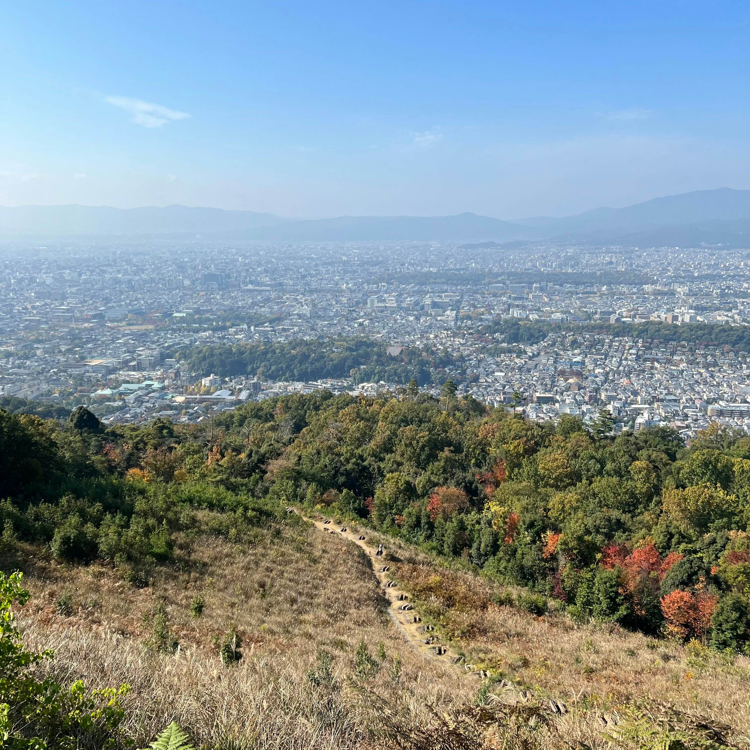
3. Mt Daimonji
Best hike for panoramic views
1.5km (0.9 miles) round trip, 1 hour, moderate
The Daimonji hike is short and sweet, leading you to one of the best viewpoints over Kyoto. Beginning and ending at the elegant "silver temple" of Ginkaku-ji in Northern Higashiyama, the hike involves a steep 220m (722ft) ascent from the shrine's main gate to a hilltop viewpoint looking out over the city.
To find the trail, turn left before entering Ginkaku-ji and walk for about a minute until you see a stone torii, then turn right and walk up the road for two minutes until you reach a small shrine. Turn right at this shrine and make your way up the hill to begin the hike.
After a bridge crossing, several flights of log steps, a climb up a gentle scree slope and three flights of concrete stairs, you'll have covered the bulk of the climb. The final stage is an easy walk up one last set of steps to reach the Daimonji viewpoint, with a breathtaking view of Kyoto city stretching out to your right.
Detour: If you're in the mood for an extra workout, you can continue uphill for another 20 minutes to reach the true summit of Mt Daimonji – but this is not essential if you came here to see the spectacular views over the city.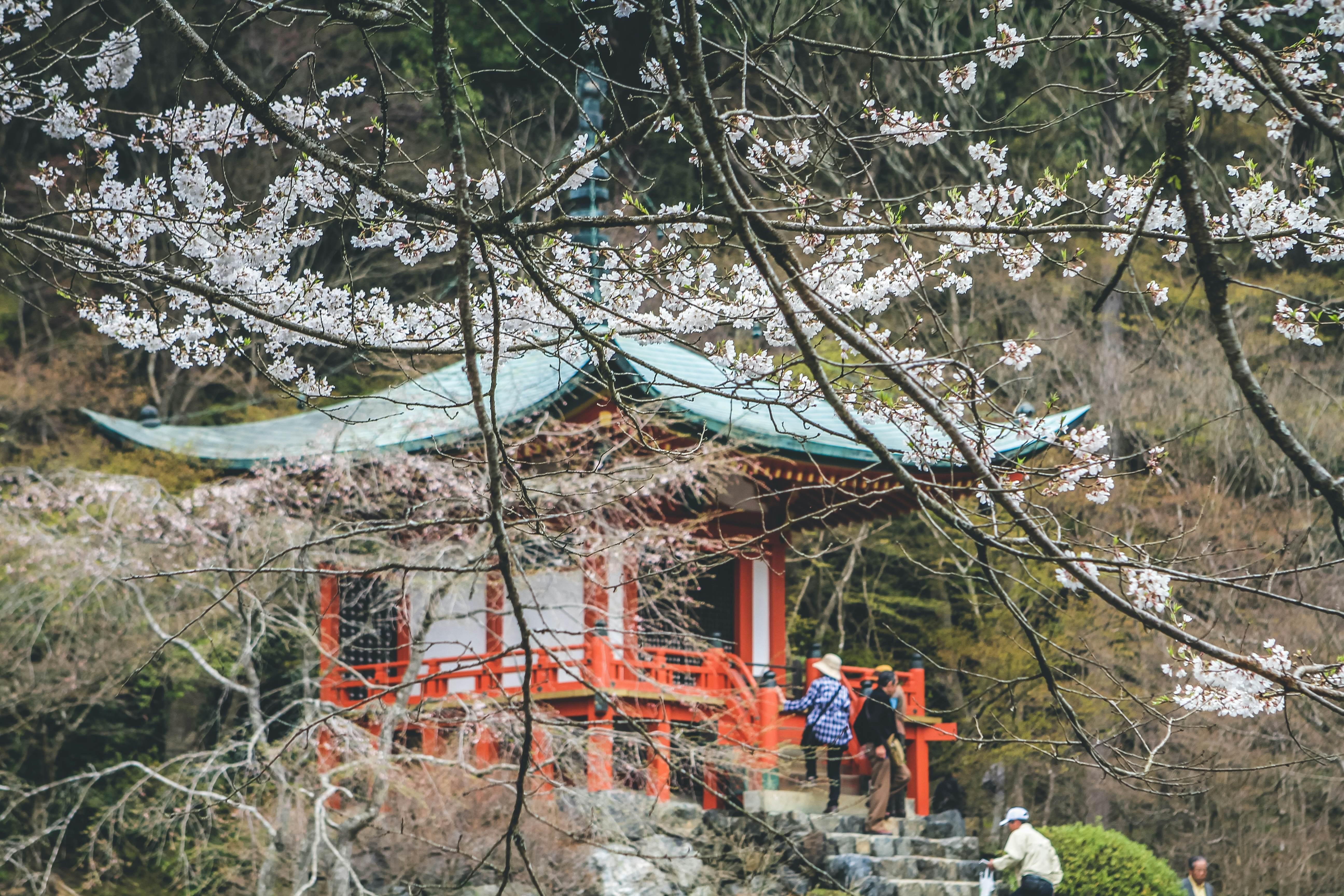
4. Daigo-ji trail
Best hike for stepping through the centuries
5km (3 miles) round trip, 2–3 hours, easy to moderate
Located southeast of central Kyoto, World Heritage-listed Daigo-ji is one of the key temples for the Shingon sect of Japanese Buddhism. The temple complex spreads up the slopes of Daigoyama mountain – the main temple grounds are located at the base of the mountain but a scenic hiking trail connects to another cluster of temple buildings at the summit.
Picturesque in all seasons, the trail at Daigo-ji is particularly stunning in fall and spring, when the forest comes alive with fall foliage or blossom. Take your time exploring the lower shrines, then follow a steep, calf-crunching forest path to the top of the mountain, passing a pretty little waterfall at Shimo Daigo (Lower Daigo).
You'll find a stream of pilgrims and tourists climbing through the bamboo groves to the temple's original buildings at the summit, known as Kami Daigo (Upper Daigo), which were founded in the 9th century CE. From the top, you can soak up spectacular views to the south toward Nara and Osaka.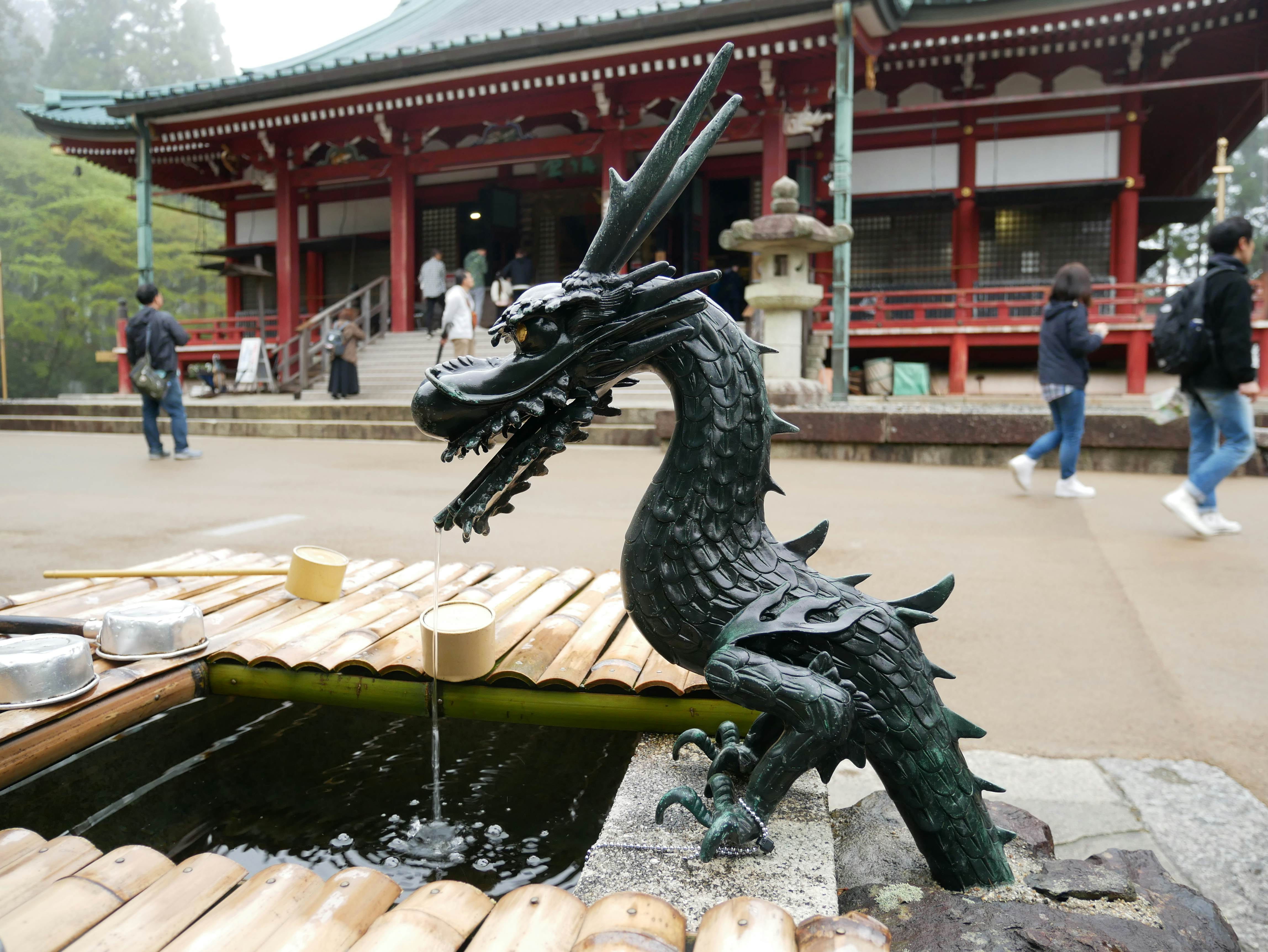
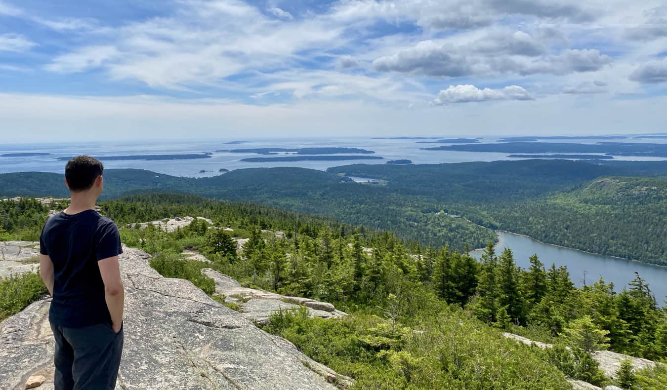
5. Mt Hiei climb
Best hike for temple traditions and unspoiled nature
8km (5 miles) round trip, 4–6 hours, challenging but accessible
Sacred Mt Hiei straddles the border between Kyoto and Shiga prefectures to the northeast of Kyoto city, and its 848m (2782ft) summit is home to handsome Enryaku-ji, a sprawling temple complex that serves as the headquarters of the Tendai sect of Buddhism in Japan.
The shrine is also famous as the home of the "marathon monks," who attempt to achieve enlightenment through a grueling 1000-day running ritual known as sennichi kaihōgyō, involving repeated circuits of Mt Hiei. Visiting hikers can get a taste of the experience on the hike to the summit.
Cable cars whisk day-trippers to the top, but following in the monks' footsteps and hiking up is the best way to appreciate Mt Hiei's beauty. You can follow several different trails – one of the most enjoyable and easily accessible starts about a 15-minute walk from Shūgakuin Station on the Eizan line.
The start of this path is steep and narrow, and you'll find yourself scrambling over uneven rocks and under low-hanging tree branches. Further up, the path becomes clearer and leads you through a forest of towering cedar trees with handy steps built into the mountainside to help you reach the peak.
You can make the climb all year round, although you'll need appropriate cold-weather hiking gear if climbing in winter, when ice and snow cover the summit. Allow extra time to explore Enryaku-ji's buildings, which are full of intriguing architectural details, and admire the views once you make it to the top.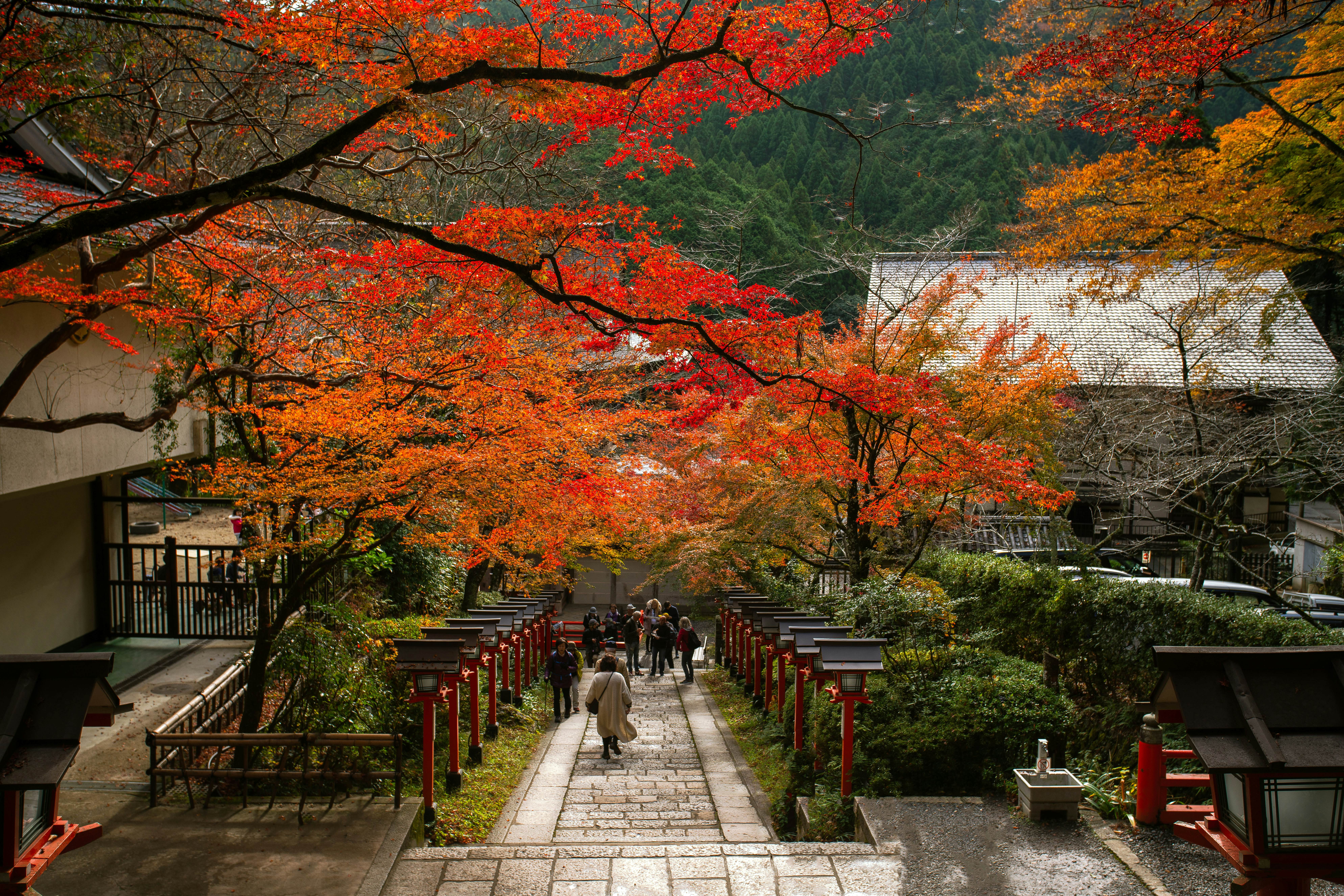
6. Kibune-to-Kurama walk
Best hike for escaping into picturesque surroundings
5km (3 miles) one way, 2–3 hours, easy
Just half an hour north of downtown Kyoto on the Eizan train line, Kibune feels a world away from the city. One of the most accessible half-day hikes in the prefecture, the Kibune-to-Kurama route offers up picturesque shrines, mountain temples, gushing rivers, lush forests and tranquil villages.
Starting at Kibune-guchi Station, take a 2km (1.2 mile) walk along the river to Kifune Shrine. Here, you'll find an iconic stone staircase lined with red wooden lanterns leading up to the shrine's main hall. Nearby, a small vermilion bridge takes you across the Kibune River and onto the slopes of Mt Kurama.
The path from Kibune to the village of Kurama is a relatively easy trek, dotted with shrines and natural wonders such as the Kinone-sando (literally, "tree root path") – an area where cedar roots have forced themselves up out of the ground in a striking display of nature's power.
Toward the end of the trail, you'll reach an evocative temple, Kurama-dera, which became independent from the Tendai school of Buddhism in 1949. Finally, after strolling through the guardian gate known as Nio-mon, you'll arrive at the quaint township of Kurama, lined with traditional Japanese wooden houses known as nagaya.
Detour: A five-minute walk south along Kurama's peaceful main street is Kurama Onsen, whose hot spring waters are rich in hydrogen sulfide and bubbling with minerals believed to have skin-rejuvenating effects. Bathing in these waters while gazing out at the scenic mountain landscape is the perfect end to a day spent on this enchanting trail.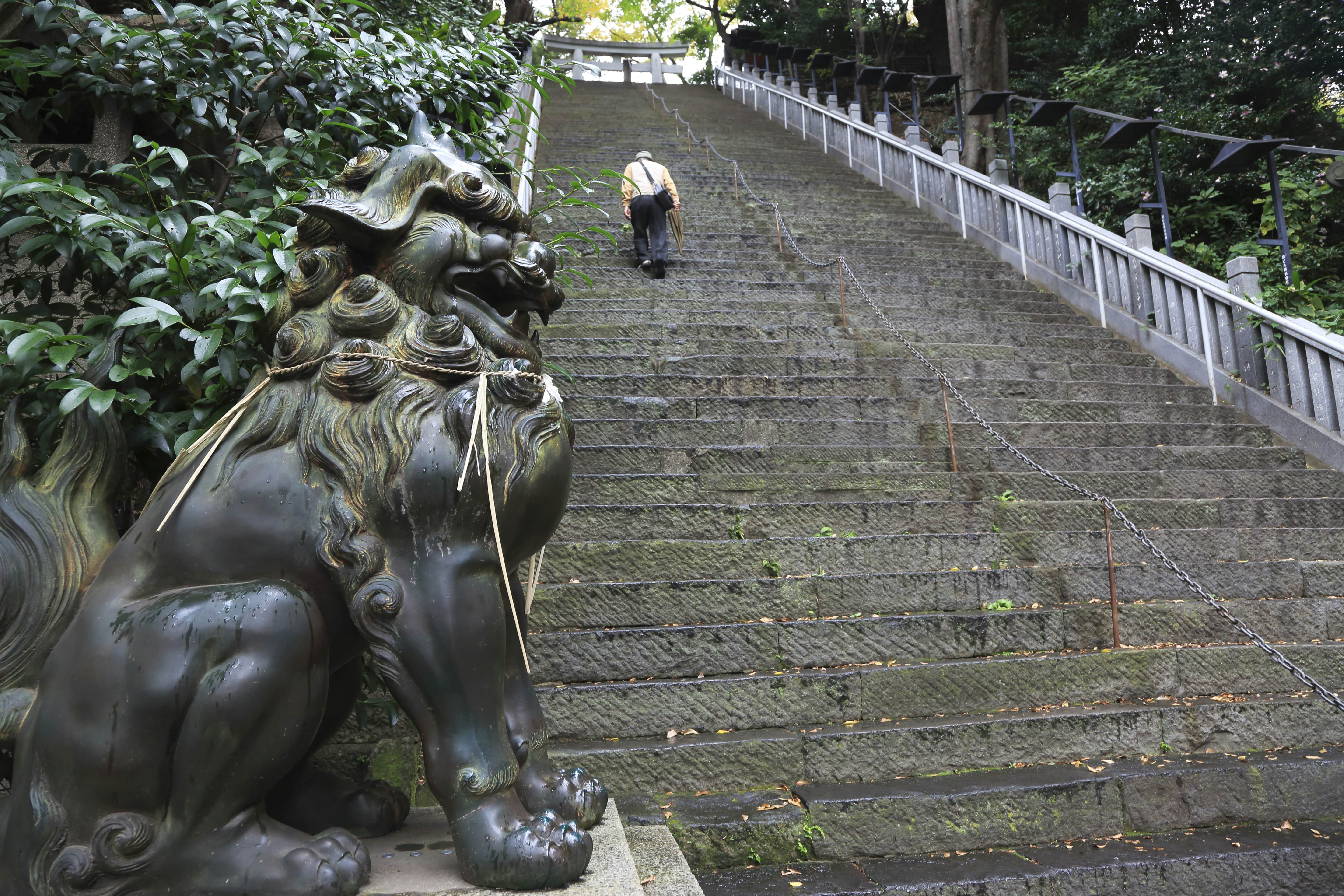
7. Mt Atago ascent
Best hike for a workout
4km (2.5 miles) round trip, 4–6 hours, challenging
The only way to reach the summit of Kyoto's highest mountain, 924m (3032ft) Mt Atago, is on foot. Located northwest of the city, this lofty peak is open for hiking year-round, though conditions in winter can be daunting, requiring proper cold-weather gear.
Start from the Kiyotaki bus stop and head northwest down the road and across a bridge. The trailhead is a five-minute walk through peaceful Kiyotaki village, marked by a red torii. From there, the trail snakes its way for roughly 4km (2.5 miles) up the mountainside.
While the route is well-marked and easy to follow, it does involve climbing seemingly endless sets of steps. Just before the highest point, you'll find a wide-open area with benches scattered around where you can rest and refuel while admiring the views over Kyoto.
At the summit sits the small Atago Shrine, which is believed to offer protection against fire-related disasters. Japanese parents often come with young kids in tow, as visiting the shrine before the age of three is said to grant lifelong protection from fire.