


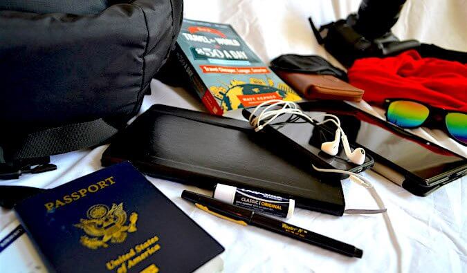


See the best of Grand Teton and Yellowstone National Parks on this road trip
This driving route through Grand Teton and into Yellowstone goes the long way so you can experience the best of the two national parks.
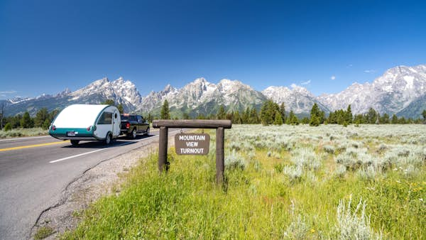
While Wyoming is home to just two of the USA's national parks – Grand Teton and Yellowstone – they make up for their headcount in pristine, dramatic landscapes. The greatest news of all is that the parks are within 50 miles of one another, meaning you can experience both parks' grandeur in one nature-packed road trip.
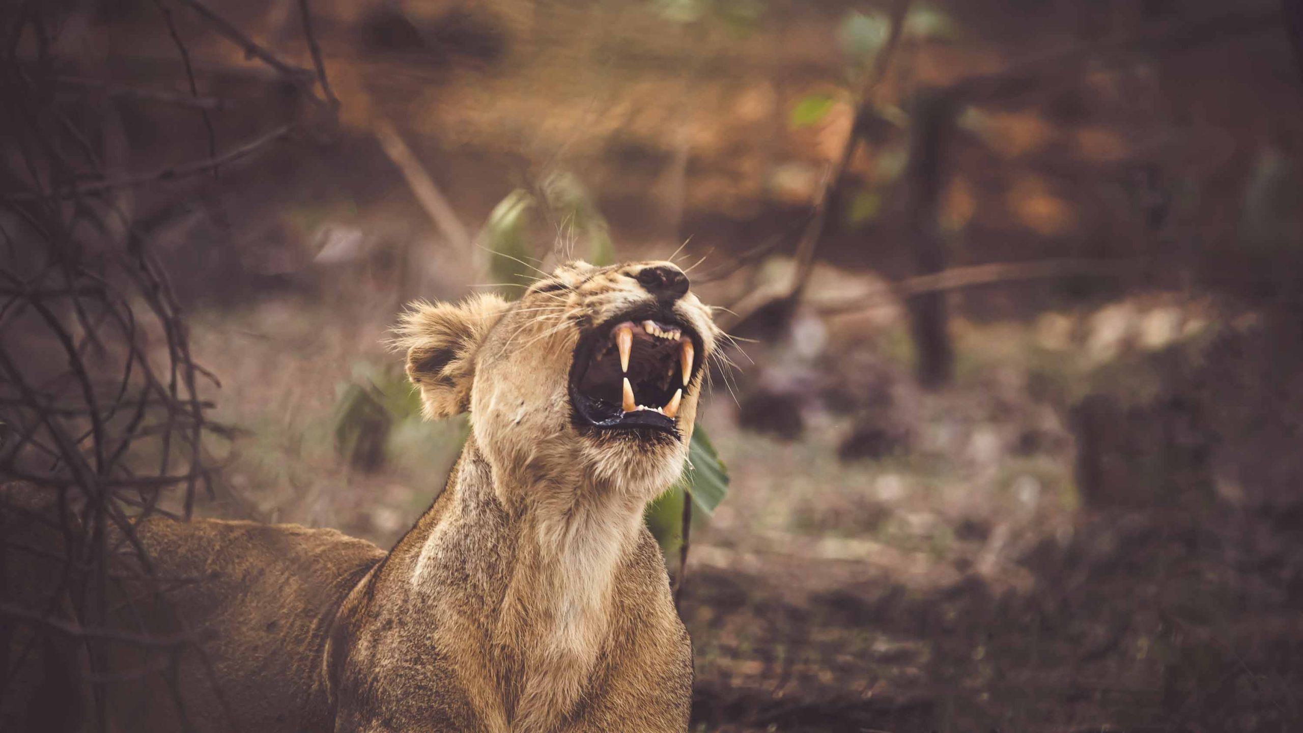
Begin near Grand Teton in Jackson, and you’ll be overwhelmed by the craggy peaks of the Tetons towering above the pristine Snake River Valley. Approaching Yellowstone from the south, you have a good chance of spotting herds of bison, lumbering grizzlies and packs of wolves as you drive past the country’s largest alpine lake and countless gushing waterfalls.
Watch the Rockies unfold on this glorious Wyoming road trip with plenty of wildlife en route.
Start: Jackson, Wyoming
End: Yellowstone National Park
Duration: 7 days
Distance: 263 miles (423km)
Best time to go: June through September is usually snow-free and full of wildlife.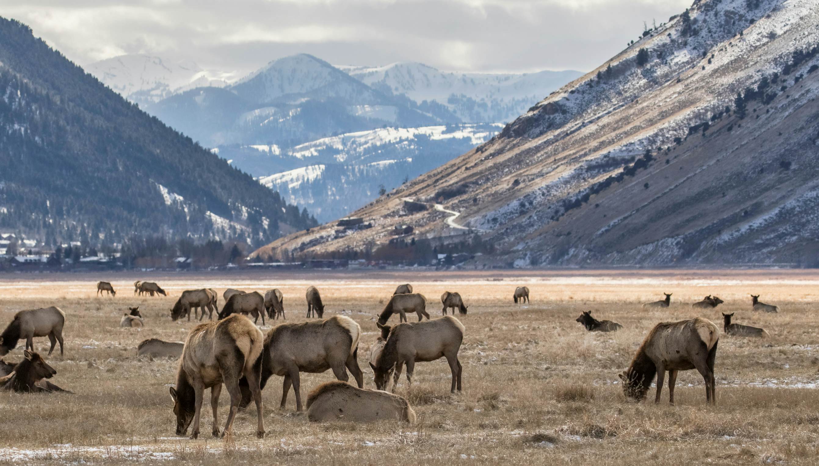
Start: Jackson, WY
Just south of Grand Teton National Park, the rustic-haute saloon town of Jackson is much more than a park gateway. A destination on its own, this world-class skier magnet is also a summer stunner, with plentiful outdoor activities, galleries and a shopping scene that reaches beyond trinketry into the realm of cool boutiques and tailored outdoor gear. Don’t skip the National Museum of Wildlife Art, where major works by Remington and Bierstadt offer perspectives on nature that will make your skin prickle. Across the street, elk herds, bison and bighorn sheep congregate in winter at the National Elk Refuge, though it’s mostly a feast for birders in summer. Finally, take advantage of a foodie scene that’s among the best in the West, with renowned chefs and an emphasis on local, farm-raised food.
The drive: Rather than shoot straight north from Jackson on Hwy 191, take Hwy 22 to the Moose–Wilson Rd (Hwy 390) past Teton Village through the Granite Canyon entrance to Grand Teton National Park ($35 fee per car). The narrow road is closed to trucks and trailers. Grizzly sightings are not uncommon. Turn into the Laurance S Rockefeller Preserve, 18 miles from Jackson.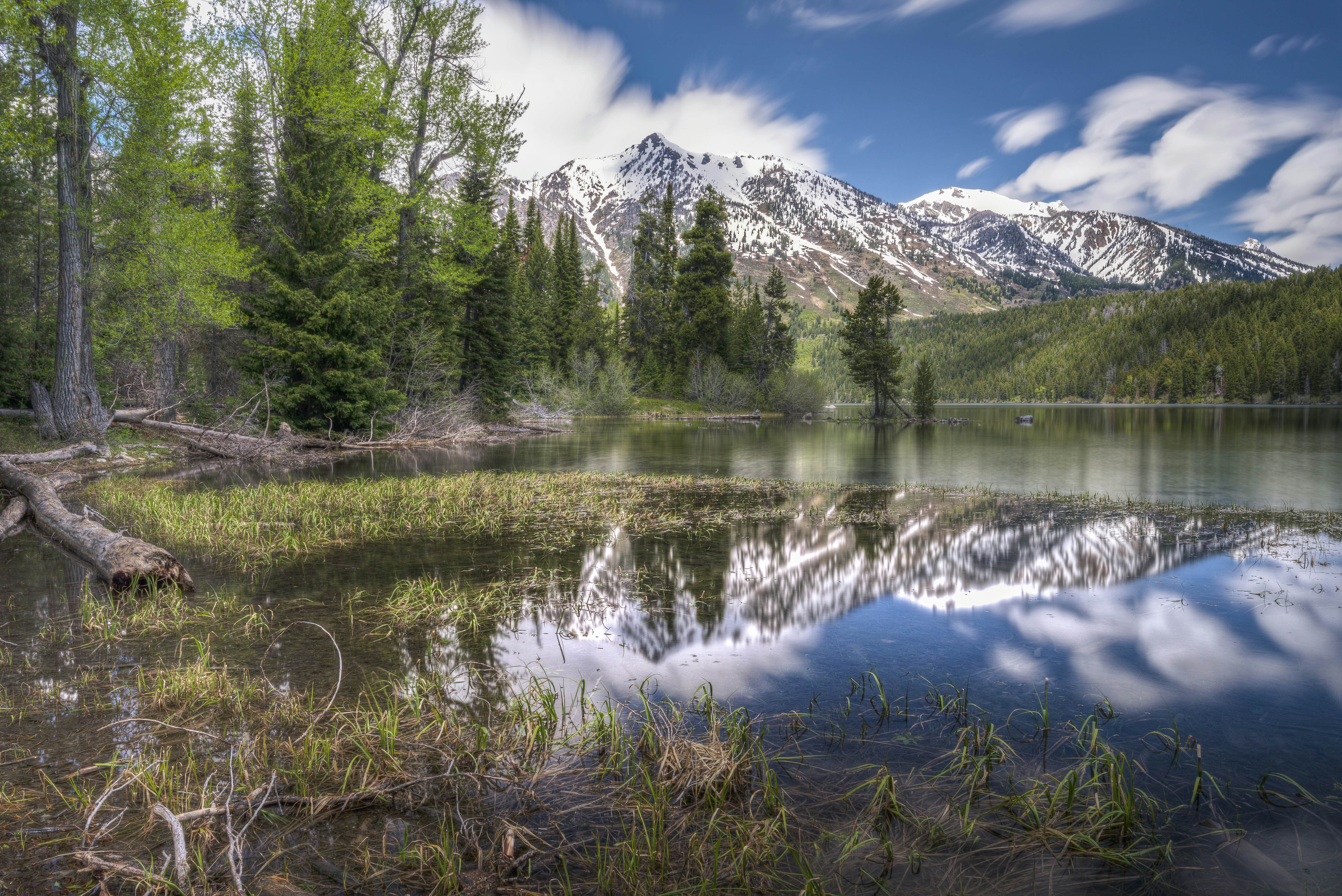
Stop 1: Laurance S Rockefeller Preserve
In contrast to conventional visitor centers, the Laurance S Rockefeller Preserve Center aims to provide a more contemplative experience. Sparsely furnished, it sets the scene for your foray into nature with inspiring quotes from naturalists etched into the walls and a gorgeous conservation library with titles best enjoyed in the leather armchairs.
Oil tycoon John D Rockefeller secretly purchased this land – and much of the Snake River Valley – when fears of a "massive government land grab" made Grand Teton National Park an unpopular idea among avaricious developers and self-interested locals. He donated it all to the park in the 1930s, save for this former dude ranch, which his son handed over in 1990. From here, you might take an easy stroll to Phelps Lake. Any part of the 7-mile loop is spectacular, but a 30ft plunge off Jumping Rock at the far end of the lake is thrilling.
The drive: The road ends in 4 miles at Teton Park Rd. Ultimately you want to go left, but you also have the option of turning right for the Craig Thomas Discovery & Visitor Center before backtracking. It's home to the Grand Teton National Park Store, exhibits and artwork, and ranger-led programs. Moving on, in 16 miles, turn left for String and Leigh Lake trailheads as well as the scenic one-way loop along Jenny Lake that will return you back south a short distance.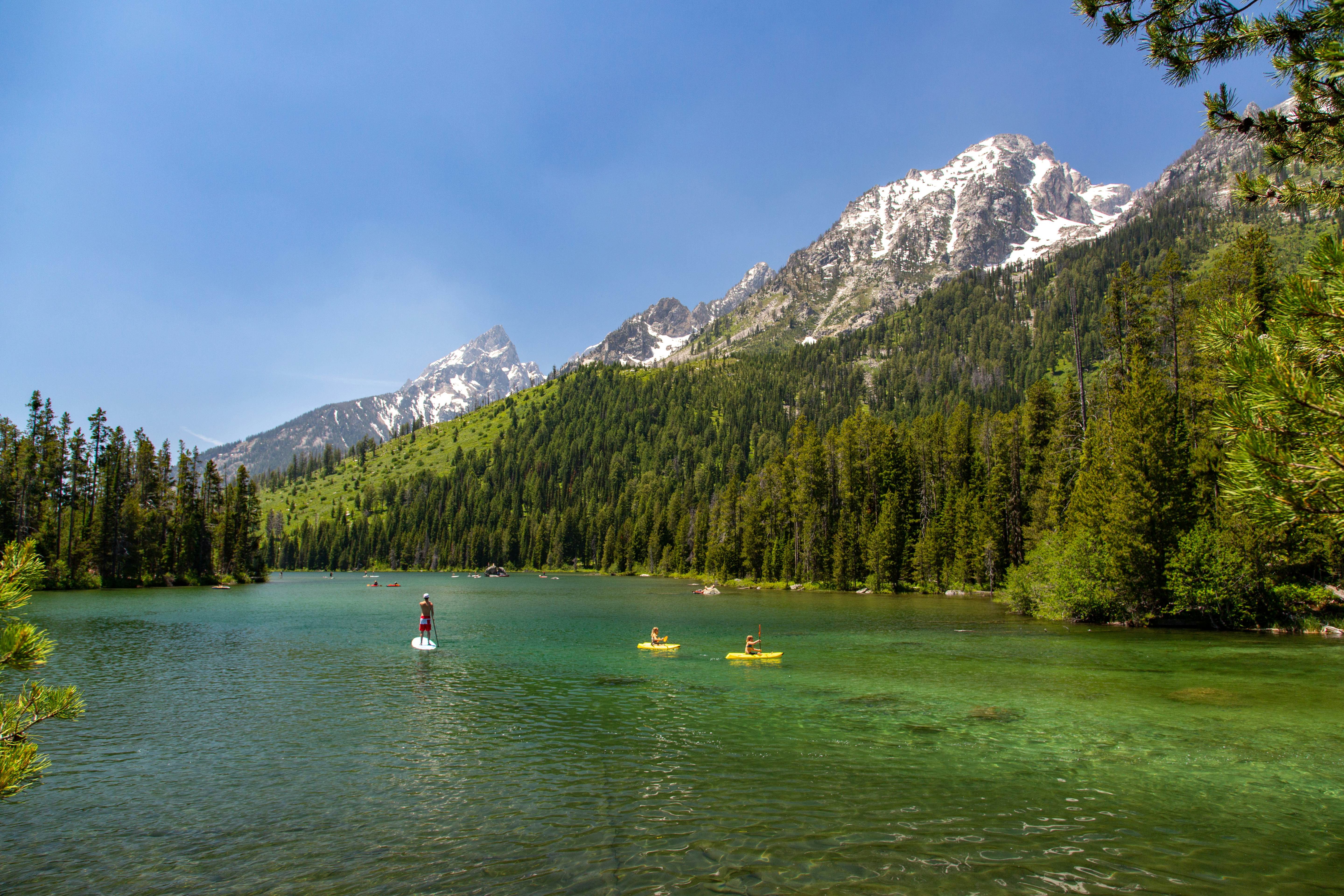
Stop 2: String and Leigh Lakes
In Grand Teton, the drive-by views are so dramatic it’s hard to keep your eyes on the road. Each turnout affords a better photo op than the last – no matter which direction you’re going. Prepare for adventure in Moose, where you can rent a canoe or paddleboard and head for String Lake and Leigh Lake trailhead. This adventure involves a mellow paddle through rocky String Lake to a short portage to Leigh Lake, which opens up considerably. Float, swim and enjoy views of the craggy peaks from your own beach. Better yet, reserve a waterfront backcountry campsite. These shores also make for a great, gentle hike, suitable for all ages. String Lake trail is a 3.3-mile round trip on foot.
The drive: Take a left out of the Jenny or String Lake areas to Teton Park Rd. As you head 13 miles north, the landscape turns from sagebrush to pine forest, climbing near densely forested Signal Mt Rd (a worthy side trip). At the Jackson Lake Junction go right to Oxbow Bend, almost immediately after the turn on your right.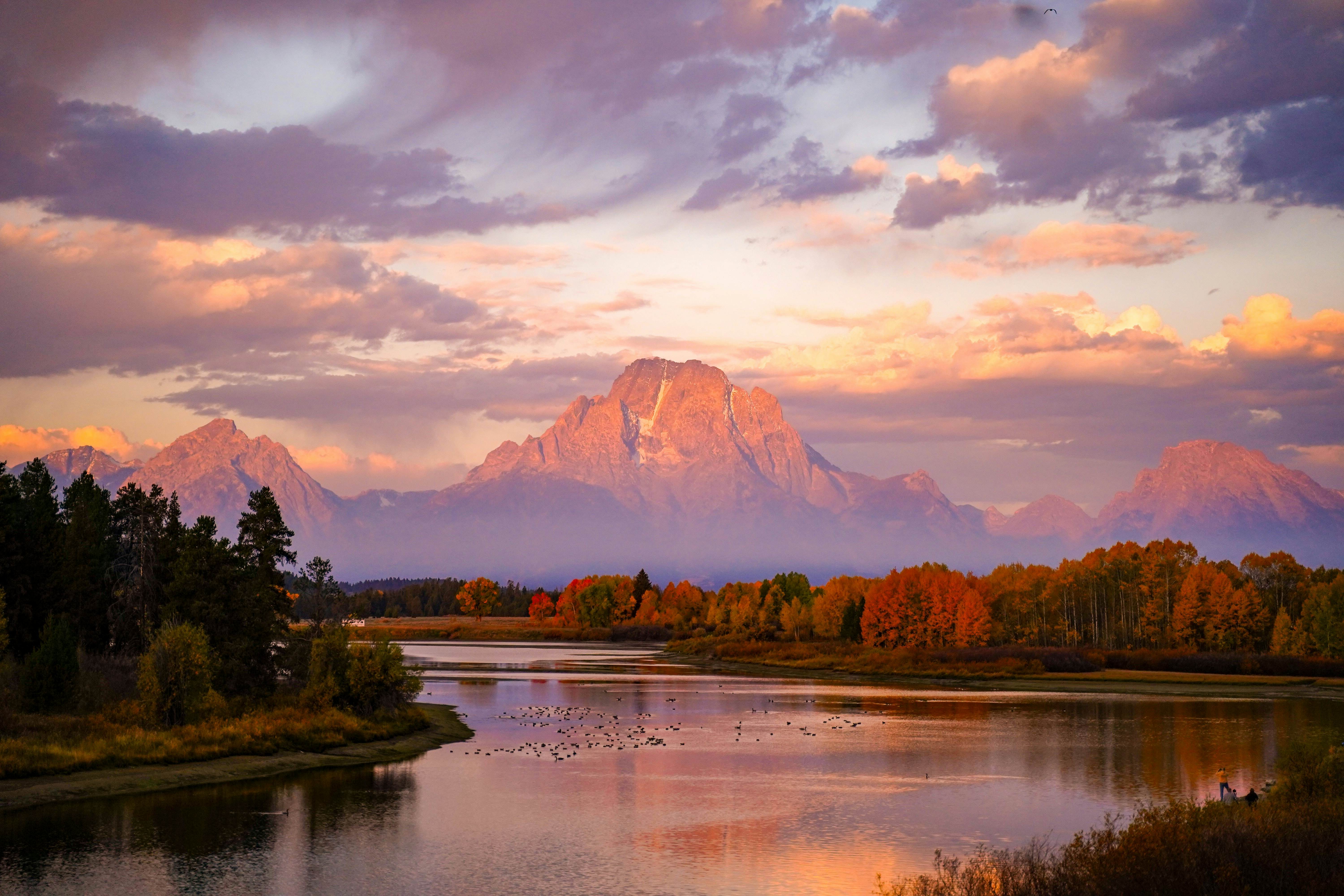
Stop 3: Oxbow Bend
Located 1.2 miles east of the Jackson Lake Junction, Oxbow Bend is one of the most scenic views in the valley, with the stunning backdrop of Mt Moran reflecting off the placid Snake River. During many sunsets, the banks will be lined with photographers looking for their next masterpiece by nature. Families enjoy rafting the mellow section of Snake River that runs through the park, with views of sharp snowbound peaks. Contact a Jackson outfitter to book a half-day trip. These wet lowlands are also prime wildlife habitat, so bring binoculars. Early morning and dusk are ideal for spotting moose, elk, sandhill cranes, ospreys, bald eagles, trumpeter swans and other birds.
The drive: From Oxbow Bend, backtrack toward Jackson Lake Lodge before continuing north for 65 beautiful but slow miles on Hwy 191 past Jackson Lake to Yellowstone. After entering Yellowstone National Park, the straight road climbs to the Continental Divide (7988ft). At West Thumb junction, continue straight. This will take you over Craig Pass (8262ft) toward Old Faithful.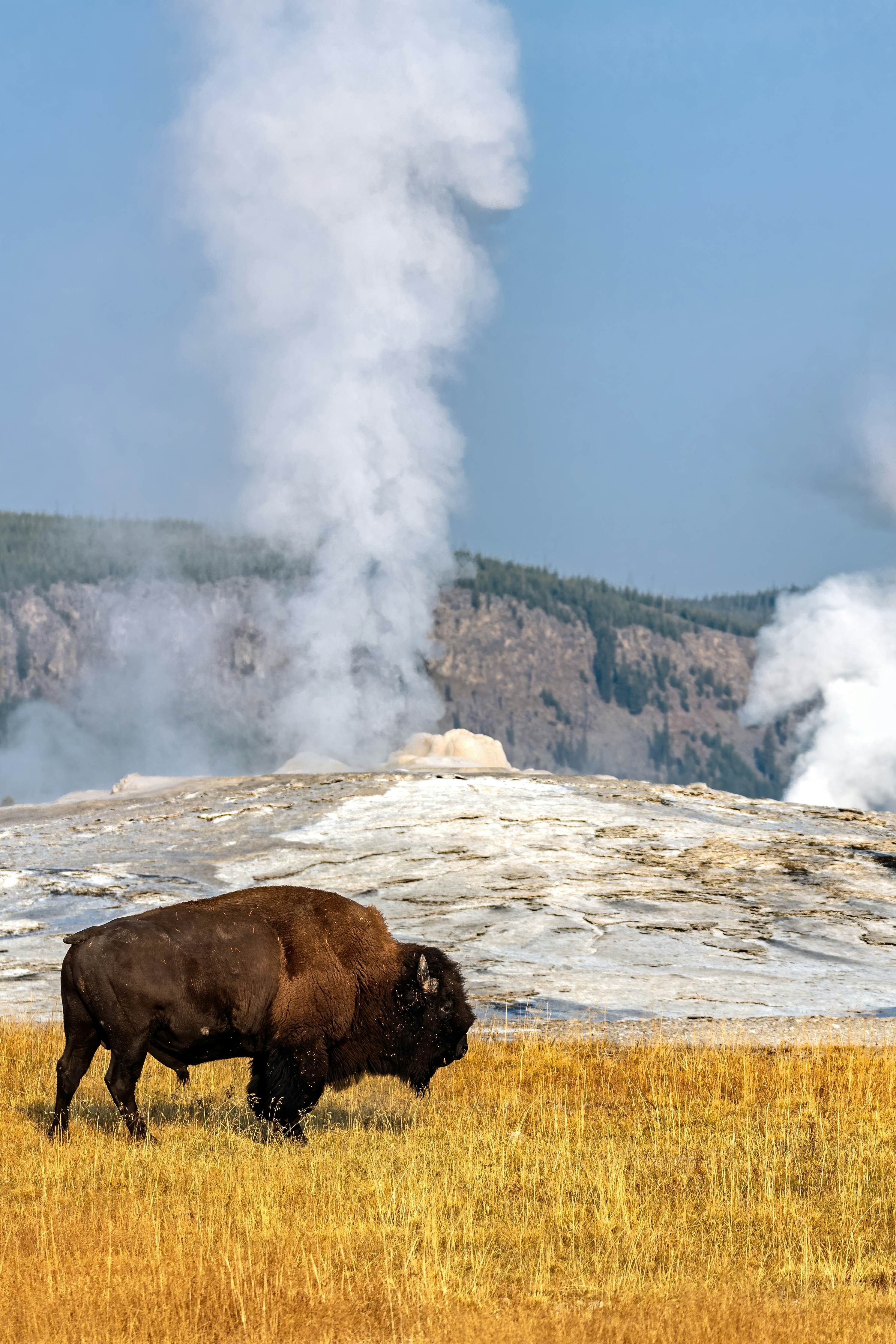
Stop 4: Old Faithful
Yellowstone National Park, America’s first – and arguably its most diverse – national park, covers an astounding 3472 sq miles. You could spend a year here and not see it all. Make a quick stop at Grant Village Visitor Center to put the 1988 fires that burned one-third of the park into perspective, before heading west on the loop road to the Old Faithful Visitor Education Center, which demystifies geyser plumbing and has predicted times for famous eruptions. Spouting some 8000 gallons of water over 180ft high, Old Faithful pleases the crowds roughly every 90 minutes. If you just missed a show, fill the wait with a 1.1-mile walk to Observation Hill for an overview of the entire basin. Loop back via Solitary Geyser (whose sudden bursts come every four to eight minutes) before rejoining the boardwalk. Another prime viewing spot is the porch of historic Old Faithful Inn. Even if you’re not staying over, treat yourself to a cocktail in the cavernous log lobby.
The drive: From Old Faithful overpass, it’s only 16 miles to Madison Junction, but these are action-packed. If driving out and back (to loop back to Yellowstone Lake), you might consider taking all the easterly right-hand turnouts first, and following with the west-side turnouts while heading south the following day after camping at Madison.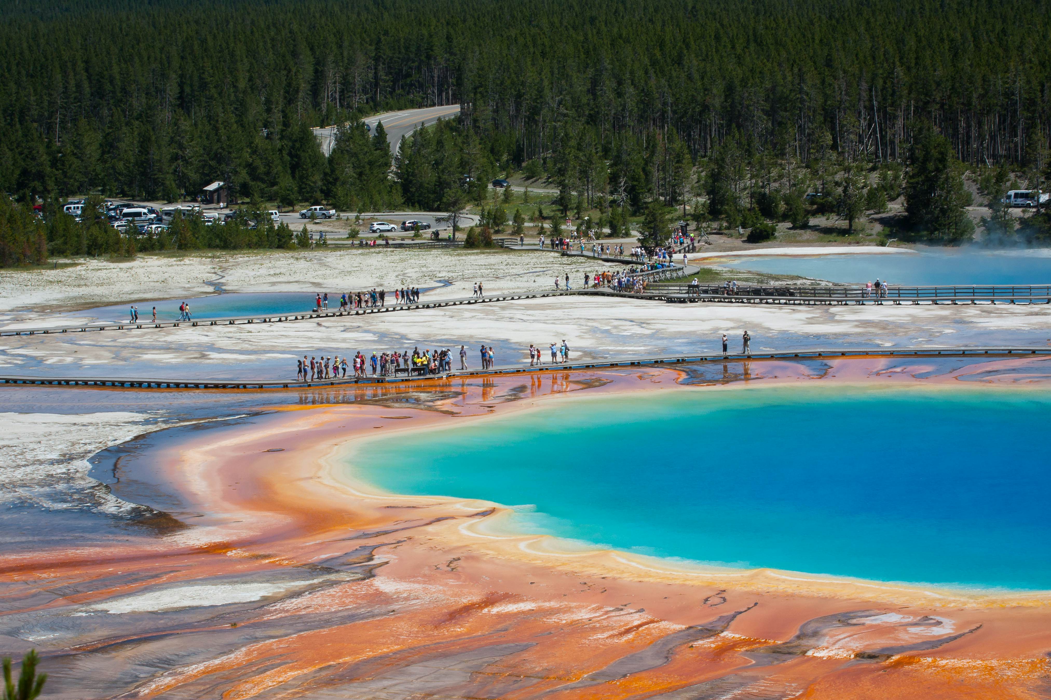
Stop 5: Grand Prismatic Spring
Exploring Geyser Country can take the better part of a day. Unlike the wildlife, these spurting geysers, multihued springs and bubbling mud pots are nearly guaranteed to show up for the picture. Leaving Madison Campground, backtrack 2 miles south and take Firehole Canyon drive on your right past rhyolite cliffs to Firehole Falls and swimming area. Five miles south, a pullout offers fine views of the smoking geysers and pools of Midway Geyser Basin to the right, and Firehole Lake Basin to the left, with bison making it a classic Yellowstone vista. One mile on, take a right for Fountain Paint Pot, a huge pool of plopping goop and assorted geysers. Try to stop at Midway Geyser Basin with breathtaking rainbow-hued Grand Prismatic Spring – Yellowstone’s most photogenic pool. If parking is full, consider driving south 1.5 miles to the Fairy Falls trailhead and hiking 1 mile in to a new overlook that gives an elevated view of Grand Prismatic Spring.
The drive: From Grand Prismatic Spring, drive south toward Old Faithful. The road curves west to climb back over Craig Pass before descending to West Thumb. Go left on the shoreline road to Lake Village approximately 45 miles away.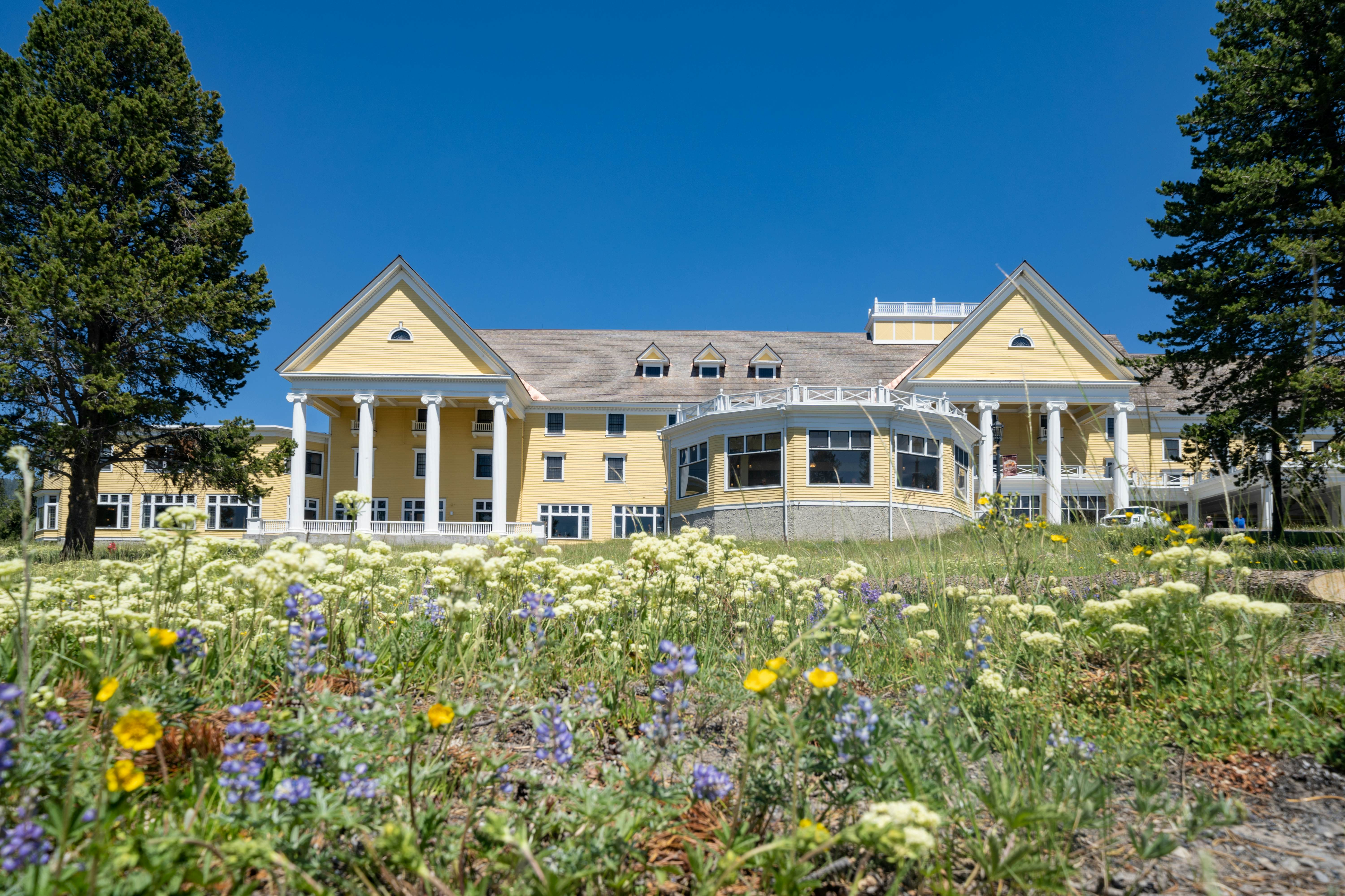
Stop 6: Yellowstone Lake
At 7733ft above sea level, shimmering Yellowstone Lake is the largest high-elevation lake in the US. Despite having a number of thermal features under it, however, the temperature remains bitterly cold at 41°F (5°C), and not great for swimming. Grand Loop Rd hugs the western shore. Stop to picnic at Sand Point, where it’s worth taking a short walk to the lagoon and black-sand beach, looking beyond to the rugged Absaroka Range. Continue north and have a rest at the 1891 Lake Yellowstone Hotel (Lake Village), the park’s oldest building. Enjoy classical concerts and cocktail hour in the sprawling sunroom of this buttercup-yellow colonial mansion – you may want to return at the day’s end. At the intersection, Hwy 14/16/20 heads east past Fishing Bridge, closed to fishing, toward Cody over what Theodore Roosevelt once called the "50 most beautiful miles in America", but for the time being, continue north to Hayden Valley.
The drive: Drive along Yellowstone Lake to Lake Village, and 10 miles north to Hayden Valley. Bear jams are frequent here; drive slowly and stop only at turnouts.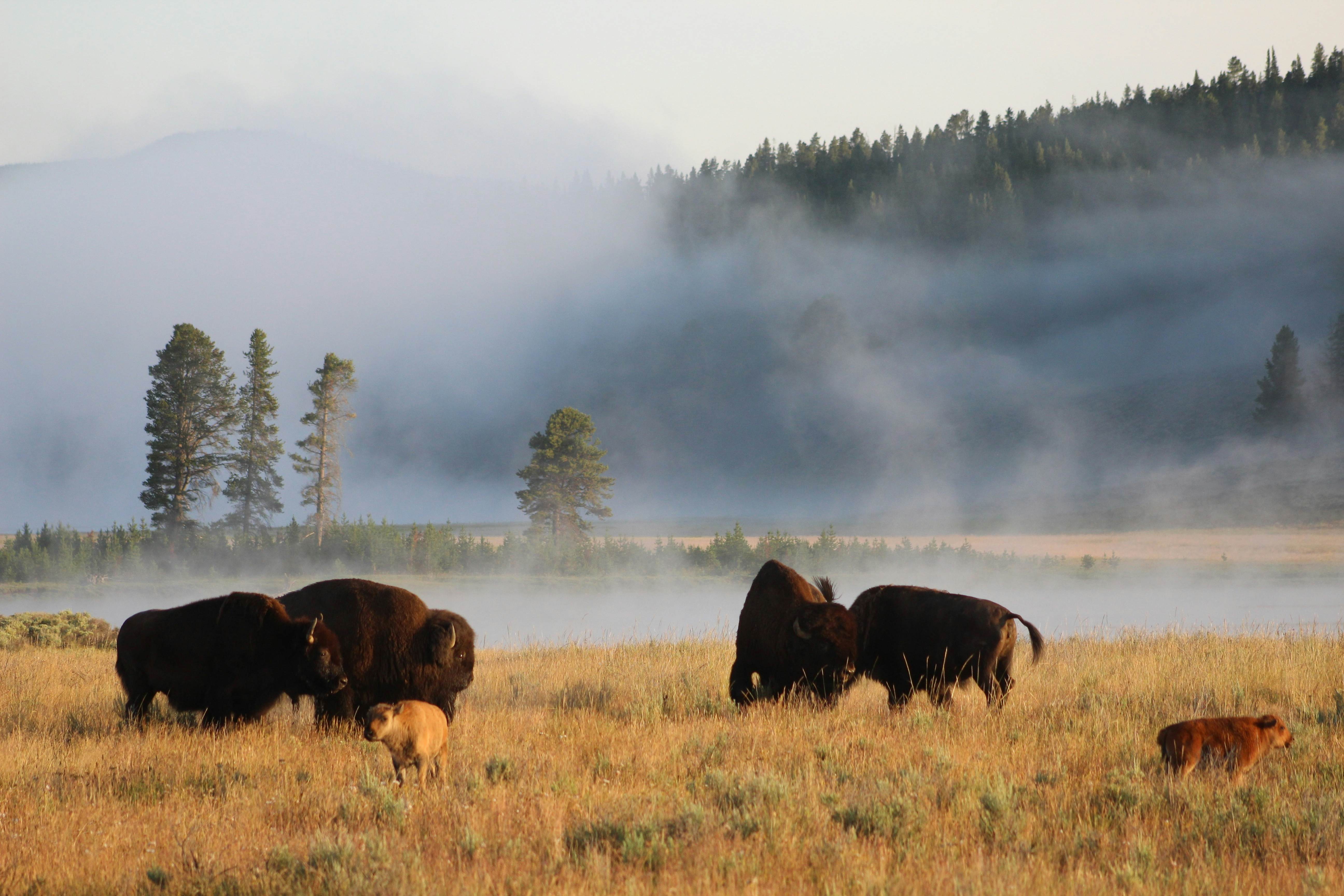
Stop 7: Hayden Valley
Flowing from Yellowstone Lake, the Yellowstone River is broad and shallow as it meanders gently through the grasslands of Hayden Valley. This is the heart of the Yellowstone Plateau, the largest valley in the park and a premier wildlife-watching spot. A former lake bed, the valley’s fine silt and clay keeps shrubs and grasses thriving, attracting elk by the herd. Watch for coyotes, springtime grizzlies and bison that turn out in the fall for the largest rut in the country. Early morning or near dusk are the best times to spot critters. Also check out the mud pots and sulfur pits at Mud Volcano, a thermal area 6 miles north of Fishing Bridge Junction. Earthquakes in 1979 generated enough heat and gases in the mud pots to cook nearby lodgepole pines. Follow the 2.3-mile loop boardwalk to see the sights.
The drive: The road runs for 5 miles north along the Yellowstone River to the Grand Canyon of the Yellowstone. This is another spot famous for bear jams (though the offender is usually bison). After the open valley changes to densely forested terrain, keep watch for the right-hand South Rim Dr with sublime views of the upper and lower falls.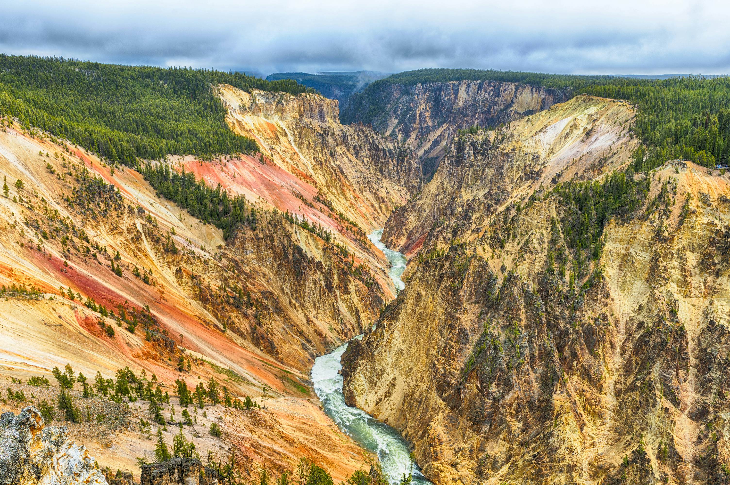
Stop 8: Grand Canyon of the Yellowstone
Here the Yellowstone River takes a dive over the Upper Falls (109ft) and Lower Falls (308ft) before raging through the 1000ft Grand Canyon of the Yellowstone. Heading north on Grand Loop Rd, take the right-hand turn to South Rim Dr. A steep 500ft descent, Uncle Tom’s Trail offers the best view of both falls (though note the trail closes at times due to poor conditions). Hop in the car again to continue to Artist Point (South Rim Dr, Canyon). Canyon walls shaded salmon pink, chalk white, ochre and pale green make this a masterpiece. A short 1-mile trail continues here to Point Sublime, worth following just to bask in the landscape. Returning to the Grand Loop, go north and turn right on North Rim Dr, a 2.5-mile one-way with overlooks. Lookout Point offers the best views of the Lower Falls. Hike the steep 500ft trail for closer action. This is where landscape artist Thomas Moran sketched for his famous canyon painting, supposedly weeping over his comparatively poor palette.
The drive: After leaving Lookout Point, stay on North Rim Dr, which winds to Canyon Village. Take a right turn on the Grand Loop to head north here for Dunraven Pass. This section is narrow and curvy with huge drops. It descends to Tower-Roosevelt junction, where you can head right (east) for 35 miles to Lamar Valley.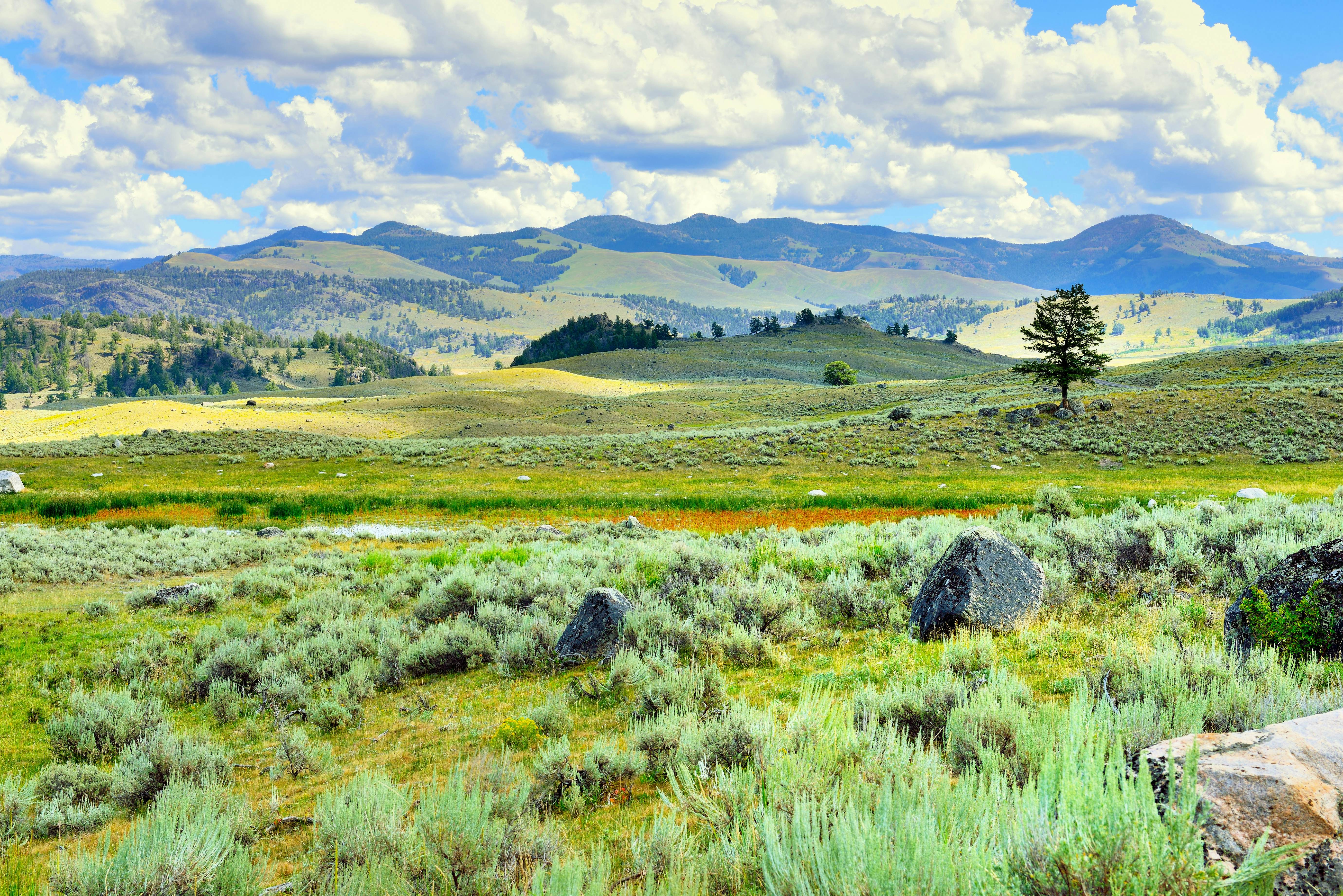
Stop 9: Lamar Valley
Take the winding road to Tower-Roosevelt, stopping at Washburn Hot Springs Overlook for views of the Yellowstone Caldera. On clear days, you can even see the Teton range. The road climbs Dunraven Pass (8859ft), surrounded by fir and whitebark pines. At the Tower-Roosevelt junction, head east through Lamar Valley (Tower-Roosevelt), a hot spot for wolves, bears, foxes, bison and coyotes. Watching a wolf pack stalk and take down an elk in a matter of seconds is truly one of the most powerful sights in the world, though without the aid of a spotting scope you may have a hard time following the action. Along this road, Buffalo Ranch hosts Yellowstone Forever Institute courses, with biologist-led wildlife-watching. The wolf-watching course is particularly fascinating.
The drive: To continue to Mammoth, turn around at Pebble Creek campground and return to Tower-Roosevelt. From here, it’s 18 miles to Mammoth Hot Springs, where there’s a visitor center and full services. Turn left for parking for the upper and lower terraces of Mammoth Hot Springs.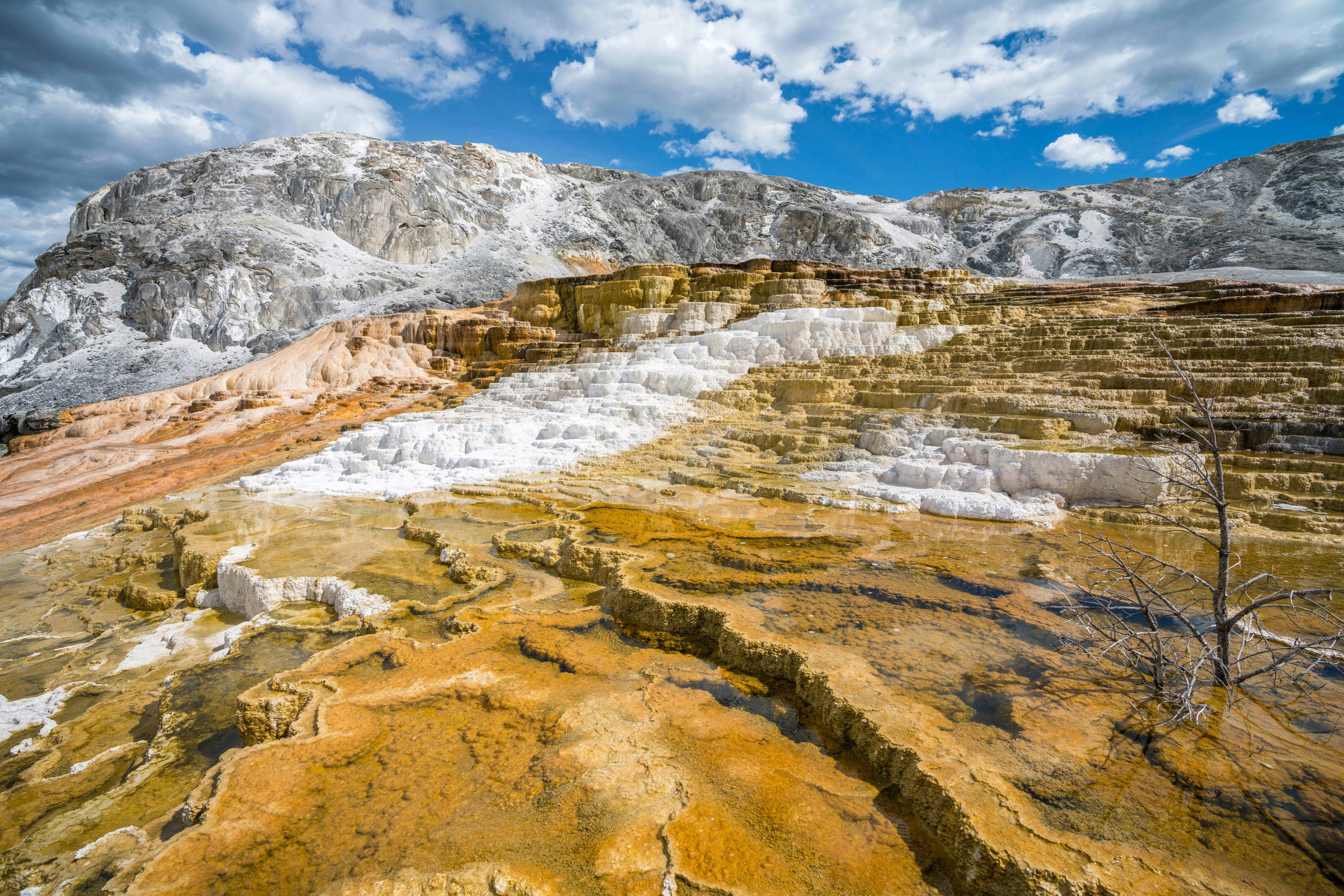
End: Mammoth Hot Springs
At over 115,000 years old, Mammoth Hot Springs is North America’s oldest and most volatile continuously active thermal area. Here the mountain is actually turning itself inside-out, depositing dissolved subterranean limestone that builds up in white sculpted ledges. There are no geysers here as the limestone substrate dissolves too readily to build up the necessary pressure. Take the one-way loop around the Upper Terraces for views, but it’s best to park at the Lower Terraces to walk the hour’s worth of boardwalks, so you can descend back to your car. End your trip with a dip in the Boiling River, a hot-spring swimming hole, reached via an easy 0.5-mile footpath from on the eastern side of the road 2.3 miles north of Mammoth. The hot springs here tumble over travertine rocks into the cool Gardner River. Though usually crowded, soaking here is still a treat. Leave the park via the north entrance and Gardiner at the Montana state line.
This article was adapted from Lonely Planet's Best Road Trips USA.