


-Baldur’s-Gate-3-The-Final-Patch---An-Animated-Short-00-03-43.png?width=1920&height=1920&fit=bounds&quality=70&format=jpg&auto=webp#)


Top 10 unforgettable hikes in Poland
Hikers are drawn to Poland by its rich variety of landscapes – from dune-backed beaches to peaks in the Tatra Mountains. Here are Poland's best hikes.

Hikers are drawn to Poland by its rich variety of landscapes – dune-backed Baltic beaches, peaks climbing above 2000m (6561ft) in the Tatra Mountains, meandering rivers, dense forests, towering limestone cliffs and thousands of lakes.
The southern Carpathian Mountain range is where much of the hiking action takes place, but the Tatra Mountains, the Baltic Coast, the Great Masurian Lakes and the forests of the east also have a lot to offer. And these diverse landscapes are steeped in history, spanning centuries of European empire-building and diverse local cultures.
Poland’s mountains are a joy to explore on foot, attracting thousands of hikers in every season. Many of the best hiking areas are protected by national parks that are crisscrossed by walking trails, most of which are clearly marked and dotted with shelters.
From the Baltic Coast to the Carpathian Mountains, here is our guide to the ten best hikes in Poland.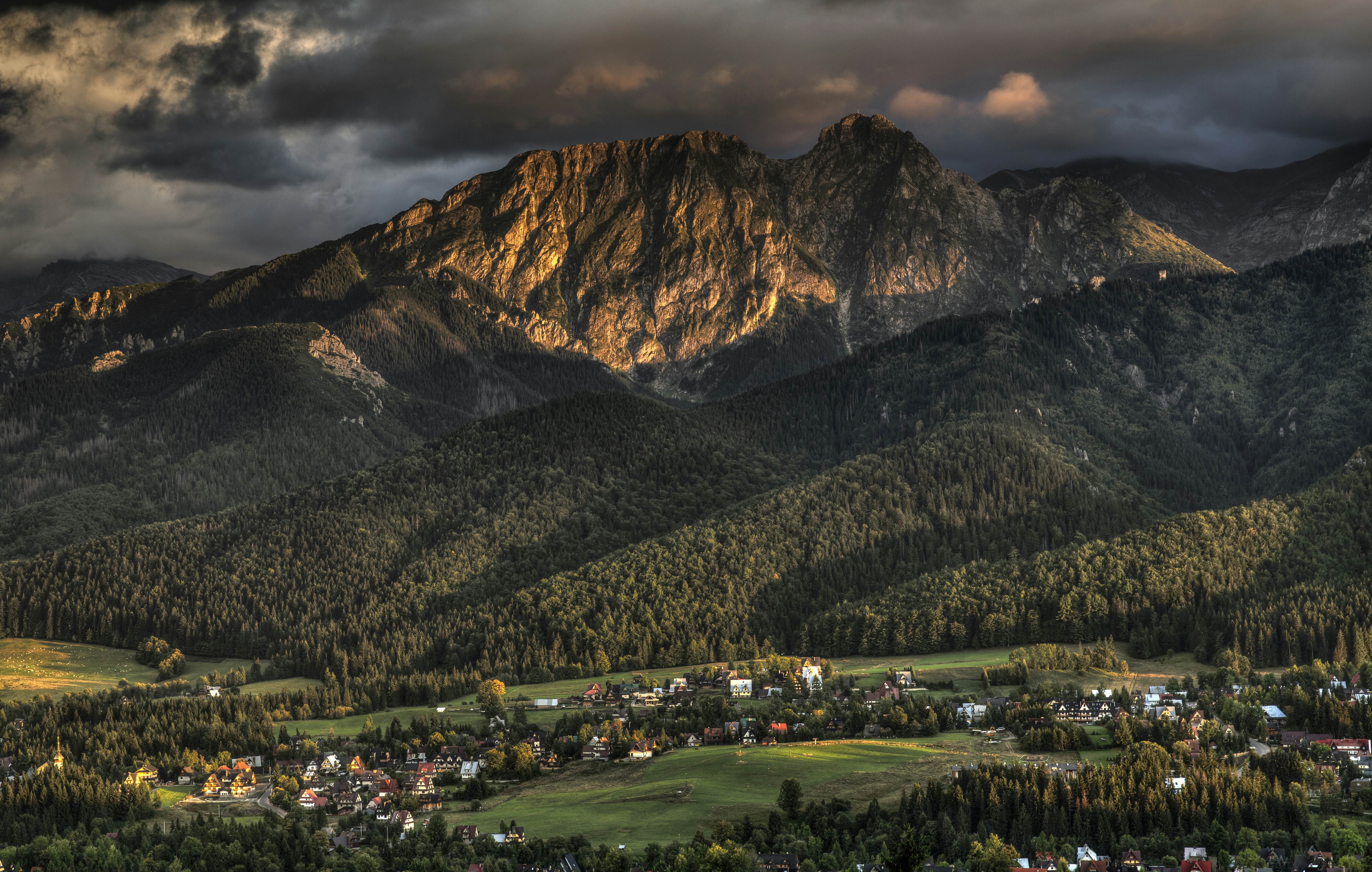
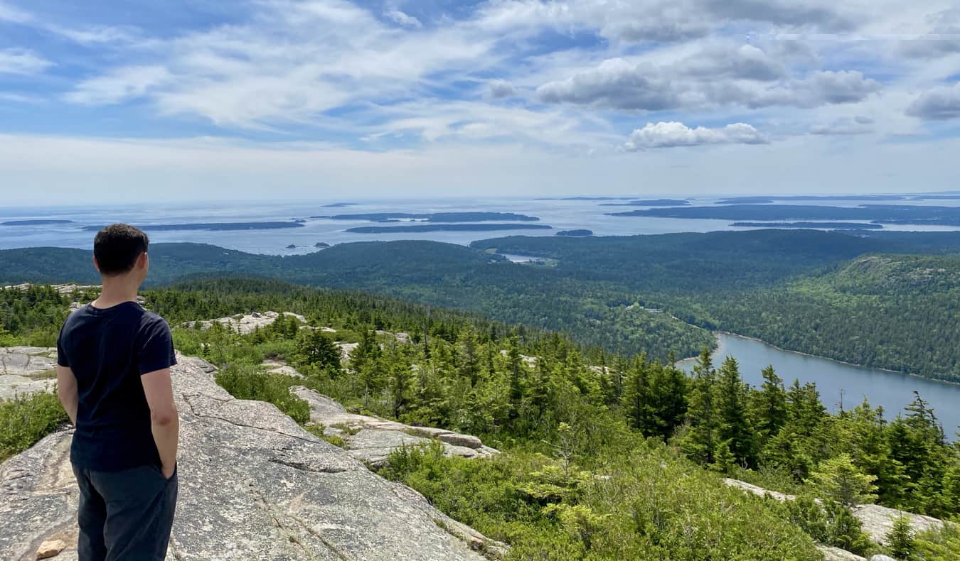
1. Hike to the iconic summit of Mt Giewont in the Tatra Mountains
Best for a classic Polish mountain experience
9km (5.6 miles) round trip, 3½ hours, moderate to challenging
No other area of Poland boasts quite such a diversity of landscapes as the Tatra Mountains. The most popular area for hiking is 212 sq km (82 sq mile) Tatra National Park, which begins just south of the mountain resort of Zakopane, with a total of 275 colour-coded trails and tracks.
The most rewarding trail in the Tatras climbs to the top of 1894m (6214ft) Mt Giewont. You can reach the summit by following the red trail from Zakopane in about 3½ hours. A reasonable level of fitness is required to attempt this climb – the hike involves more than 1000m (3281ft) of elevation gain.
As you climb, the landscape unfolds dramatically, offering sweeping views of the Tatras, taking in rugged ridgelines, jagged peaks and valleys dotted with small alpine lakes. From the top, you’ll be rewarded with one of the most spectacular panoramas in the country – it's a stunning spot for photos or simply taking in the beauty of the surrounding wilderness.
Detour: Combine the climb up Mt Geiwont with a short walk into one of the densely forested valleys to the south of Zakopane. Dolina Strążyska is the most attractive – it takes around 40 minutes to reach this charming valley and another hour to go all the way down to Zakopane via the yellow trail.
2. Experience the historic Beskid Niski region in the Carpathian Mountains
Best for hikers seeking an off-the-beaten-path, multi-day adventure
150 km (93 miles), 5-7 days (depending on pace), moderate
Krosno is one of the best starting points for hikes in the Beskid Niski (Low Beskids) mountains, a section of the Carpathians, with two popular trails covering the entire length of the range. The Blue Tourist Trail (Niebieski Szlak Turystyczny) runs from Rzeszów through Grybów to the Slovakian border and then eastwards along the frontier, eventually bringing you to Nowy Łupków near Komańcza.
Along the way, you’ll pass historic sites and traditional wooden churches and huts that reflect the region's rich cultural heritage. The trail also provides stunning views of the rolling hills and wide, open valleys of the Lower Carpathians.
The Main Beskid Trail (Główny Szlak Beskidzki, marked in red) crosses the Blue Trail near Hańczowa and continues east along the northern slopes of the Beskid Niski range, dropping you at Komańcza. On either trail, you can continue east into the Bieszczady region.
Planning tip: It's a good idea to check ahead to make sure there is space in local hostels and guesthouses in the villages along the way. Alternatively, consider camping. Since the trail passes through remote areas with few amenities, be sure to bring a good map and compass and supplies. It’s also possible to sample the area on shorter hikes from Krosno, Rzeszów or Komańcza.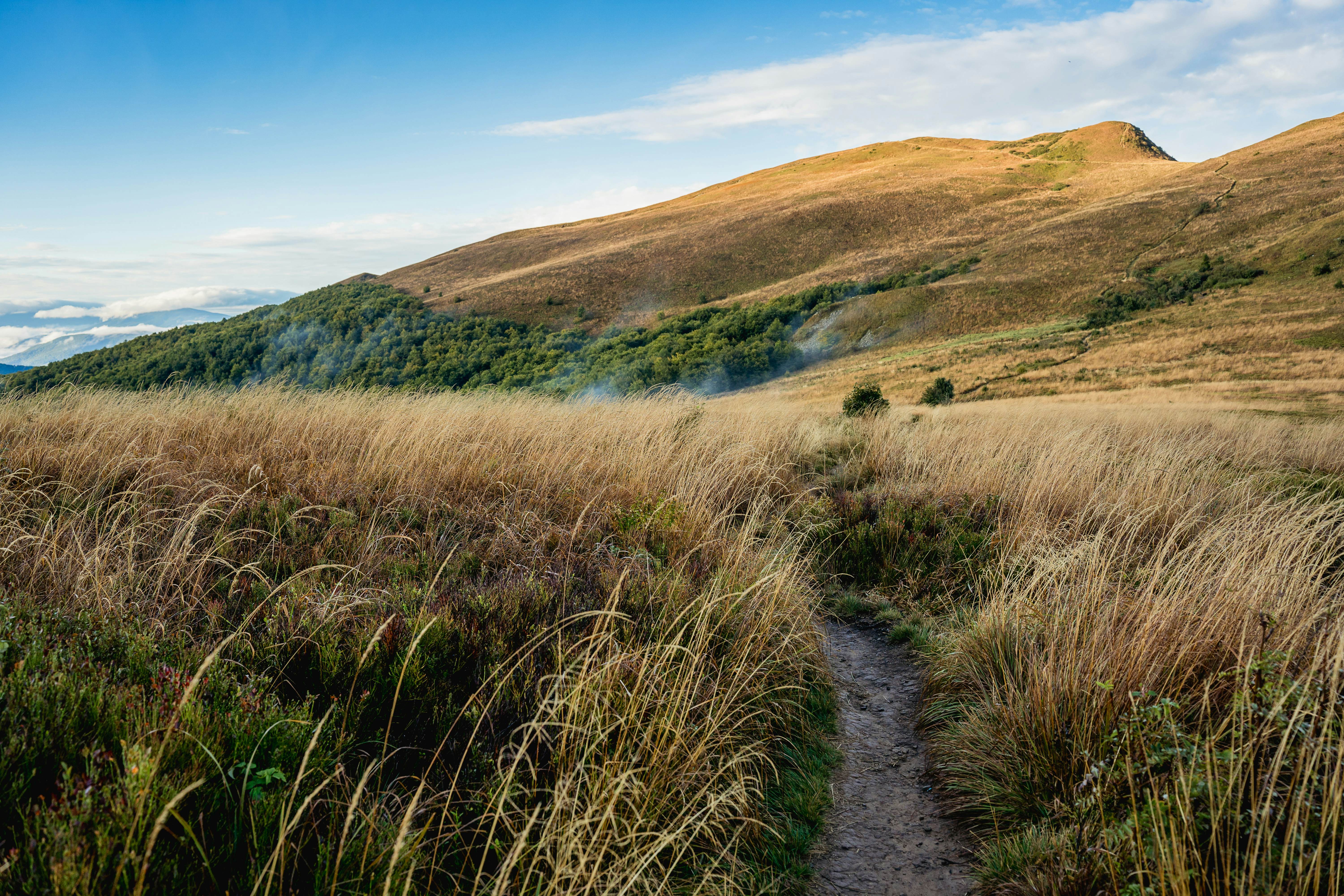
3. Explore the remote wilderness of Mt Tarnica in Bieszczady National Park
Best for nature lovers seeking solitude
11km (6.8 miles) round trip, 4-5 hours, moderate
The Bieszczady mountain range in the far southeast of Poland is one of the best places in the country to go hiking. Bieszczady National Park offers around a dozen well-marked hiking trails, with a combined length of 130km (81 miles).
The park is dotted with Polskie Towarzystwo Turystyczno Krajoznawcze (PTTK) hostels with helpful staff who can provide information, and boards giving information on the trails, complete with walking times, both uphill and downhill.
For a taste of this peaceful wilderness, the ascent of Mt Tarnica – the region’s highest peak at 1346m (4416ft) – will take two to three hours from the trailhead at Wołosate. Trails here touch (but do not cross) the Ukrainian border, so be sure to carry your passport when hiking in this area.
Planning tip: The park’s mountain hostels do their best to put hikers up for the night and provide food, regardless of how crowded they get, but bear in mind that in July and August, your bed will most likely be a space on the floor, as these places are pretty small. Be sure to carry a sleeping bag and sleeping mat, and get a copy of ExpressMap’s laminated 1:65,000 Bieszczady map, which covers the entire region.
4. Conquer the challenging summits of Mt Śnieżka and Mt Szrenica in the Karkonosze Mountains
Best for hikers looking for an exhilarating challenge
16km (9.9 miles) round trip, 6-7 hours, difficult
The Sudetes run for more than 250km (155 miles) along the border with Czechia, and the highest part of this old and eroded chain of mountains is the Karkonosze range, climbing to 1602m (5256ft) at Mt Śnieżka. These rugged peaks and valleys are protected as part of the Sudety Wałbrzyskie Landscape Park.
The range is divided by the 1198m (3930ft) Karkonosze Pass (Przełęcz Karkonoska), which separates Mt Śnieżka to the east from 1362m (4469ft) Mt Szrenica, the highest point in the western portion of the range. The park is predominantly spruce forest at lower elevations, providing wonderfully serene country for walking.
This is the most popular hiking area in the Sudetes and the park includes some 33 trails covering 100km (62 miles). The villages of Szklarska Poręba and Karpacz are the starting points for ascents of Mt Szrenica and Mt Śnieżka, respectively.
For longer walks, a popular trail (marked in red) runs right along the ridge between the two peaks, with excellent views on both sides; you can walk the whole stretch in six to seven hours. If you start early enough, it’s possible to complete the trip between Karpacz and Szklarska Poręba in a single day, using the chairlift to Mt Szrenica or Mt Kopa to speed up the initial ascent.
Planning tip: The Karkonosze range is known for its harsh climate, with heavy rainfall (or snow in winter) and strong winds and disorientating mists at any time of year. The best chances of good weather are in January, February, May and September. Several companies produce 1:25,000 “Karkonosze i Góry Izerskie” maps that also include the Izera Mountains of the Western Sudetes, to the northeast of Szklarska Poręba. 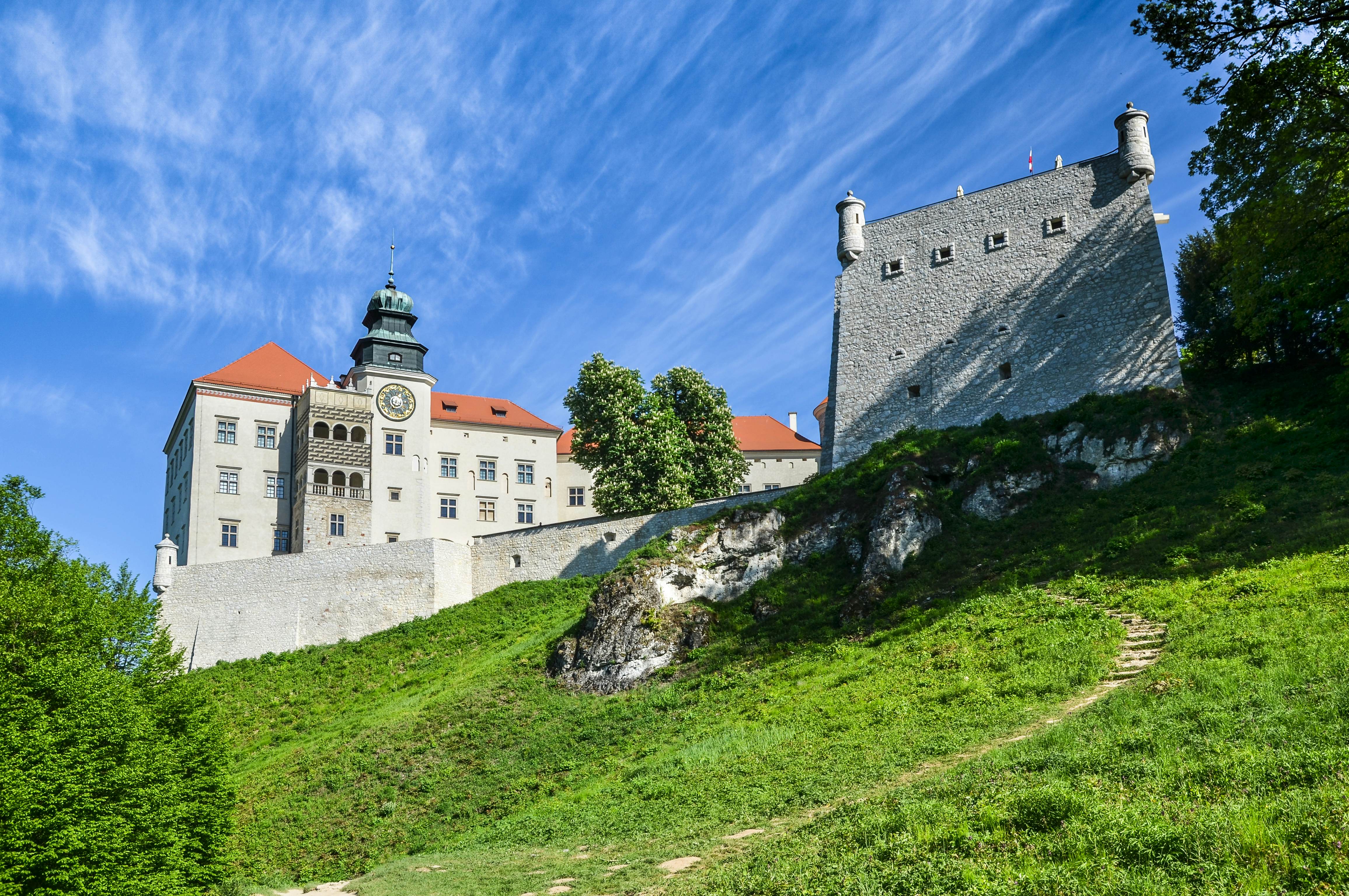
5. Uncover medieval castles and dramatic rock formations in Ojców National Park
Best for history buffs seeking dramatic landscapes
14 km (8.7 miles) round trip, 4-5 hours, easy to moderate
Ojców National Park is a worthwhile detour between Kielce and Kraków. The park’s best walk is the 14km (8.7-mile) return hike along part of the long-distance Trail of the Eagles’ Nests. The route follows the Prądnik River north through a deep valley, framed by limestone cliffs and dense forests, to the base of Pieskowa Skała Castle, a Renaissance-era reconstruction of a formidable 14th-century redoubt.
The castle has been beautifully restored and a fascinating museum contains art from the 15th to 19th centuries, including Flemish tapestries and intricate ivory-inlaid furniture. The trail also passes the picturesque Chapel on the Water, a unique structure that was originally a bathhouse in the 19th century when this was a popular health resort.
Further along, you’ll reach the ruins of Ojców Castle, where you can explore the remains of a 14th-century gate and octagonal tower, while enjoying panoramic views of the valley below.
Planning tip: For the best experience, visit in late spring when wildflowers are in bloom or early autumn for stunning fall foliage. Buy a 1:22,500 Ojcówski Park Narodowy map in Ojców village to explore the park’s walking and cycling trails.
6. Admire alpine lakes and panoramic views on Mt Jaworzyna Krynicka in Beskid Sądecki
Best for hikers seeking a challenging day hike with Tatra views
6km (3.7 miles) round trip, around 3 hours to the summit, moderate
Sitting serenely amid the wooded hills of the Beskid Sądecki range, Krynica – also known as Krynica-Zdrój (Krynica Spa) – is Poland’s largest spa and mountain health resort, and also a popular ski area in winter. From spring to fall, it’s an excellent springboard for hikes to nearby lakes and viewpoints.
Two trails, marked in green and red, head westwards up to the top of Mt Jaworzyna Krynicka (1114m/3655ft). It takes three hours to walk to the summit on either trail, and both routes wind through beautiful forest landscapes, with a calm atmosphere that feels markedly different from the bustle on popular trails in other parts of Poland.
At the summit, you'll be treated to sweeping views of the surrounding hills and valleys, and the distant peaks of the Tatra Mountains on clear days. The area is also known for its serene alpine lakes, perfect places to pause for a quiet moment of reflection before continuing your journey.
Planning tip: On either the ascent or descent, you can save time (and effort) by taking the Mt Jaworzyna cable car from Czarny Potok, about an hour’s walk west of Krynica-Zdrój. 
7. Spot wild bison while hiking the ancient Tsar’s Trail in Białowieża Forest
Best for spotting European bison in their natural habitat
4.5 km (2.8 miles), 1½-2 hours, easy
Accessible from the town of Narewka, about 21km (13 miles) to the north, Białowieża National Park is densely forested and home to more than 800 European bison – the continent’s largest land mammal.
Hikers can follow three marked trails in the park’s buffer zone, known as the Hwoźna Protective Area, without a guide and without paying an entrance fee. The best is the 4.5km-long (2.8-mile) Tsar’s Trail (Carska Tropina), which passes an observation tower and viewing point that offers a sweeping panorama of the Narewka River valley.
This relatively easy route starts from Narewka and winds along the Prądnik River, passing through a mixture of lush forests and wetlands. The terrain is varied, with sections of the trail crossing small wooden footbridges over marshy areas that are alive with birdlife.
Climb the observation tower for a perfect vantage point for spotting wildlife, particularly the wild bison that inhabit the forest. It’s a great spot to pause and soak in the tranquil surroundings, and bison are most easily spotted from October to April.
Planning tip: To enter the Strict Nature Preserve (Orłówka) section of Białowieża National Park, you’ll need to pay an entrance fee and be accompanied by a registered guide. A 4km (2.5-mile) walking trail threads through dense forests of lime, oak, hornbeam and spruce, taking you deep into the oldest and least disturbed-by-humans areas of the park.
8. Marvel at unique rock formations while hiking in the Góry Stołowe mountains
Best for hiking through surreal rock formations
6km (3.7 miles), 2-3 hours, moderate
Spilling around a high plateau studded with fantastic rock formations, the Góry Stołowe (“Table Mountains”) are one of the most spectacular sub-ranges of the Sudetes, and the area is protected by Stołowe Mountains National Park. One of the highlights of this 63 sq km (24 sq mile) national park is Szczeliniec Wielki, a plateau edged by rocky, sentinel-like pinnacles, set at 921m (3022ft).
Starting from Karłów, a small village accessible from Kudowa-Zdrój by minibus (20 minutes), you’ll ascend 728 stone steps to reach the plateau (allow 40 minutes to an hour). From here, a circles the summit, providing excellent views of the rock formations and mountain scenery.
Detour: There are more rocky outcrops to explore in the area. About 3.4km (2.1 miles) west of Szczeliniec Wielki, Błędne Skały consists of hundreds of “Errant Rocks,” some up to 11m (36ft) in diameter. This maze of outcrops forms a natural labyrinth with narrow passageways weaving between the rock formations. It’s an excellent addition to a Szczeliniec Wielki hike.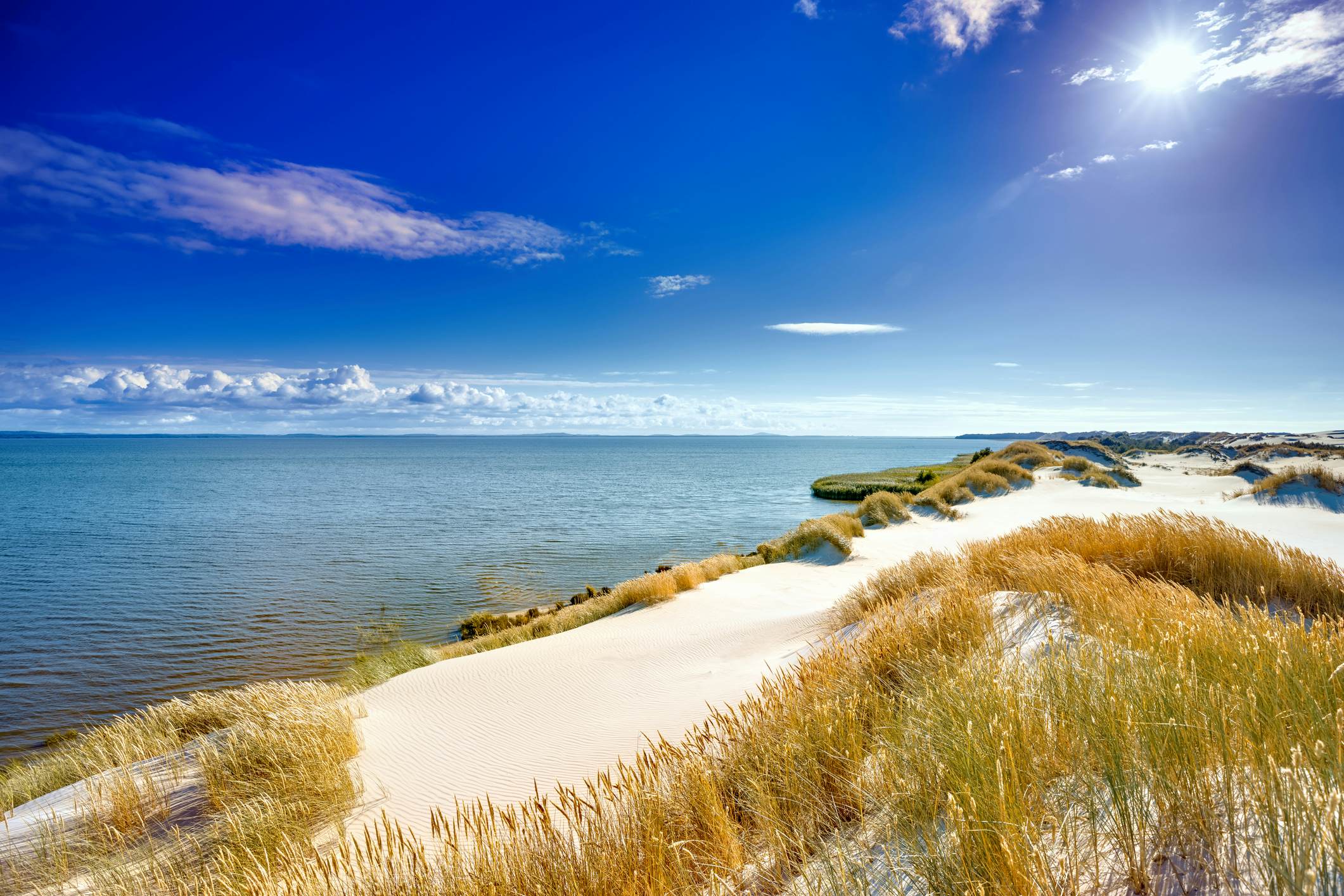
9. Soak in views of dunes and the Baltic Sea from Słowiński National Park
Best for sea air and uplifting coastal views
12.6km (7.8 miles), 2½ hours, moderate
The lively city of Gdańsk is the gateway to the Baltic Coast, which is lined with shorefront trails that form part of the international E9 hiking route linking Spain to Estonia. Walking the whole of Poland’s Baltic Coast is an ambitious undertaking, but the seaside hiking paths of Słowiński National Park are an easy excursion from Gdańsk.
Covering 186 sq km (72 sq miles), this coastal reserve is famed for its “shifting” sand dunes, which move up to 10m (33ft) per year, dividing the Baltic Sea from lakes Łebsko and Gardno. Around 260 bird species call the park home, and landscapes here cover everything from dunes, lakes and marshlands to broad Baltic beaches.
Numerous walking routes meander across the park, with access from the town of Słupsk, two hours west of Gdańsk by road or train. A good starting point is the 12.6km (7.8-mile) trail from Rąbka village to the Łącka dune, the tallest of the park’s moving dunes. En route, you’ll take in soul-restoring views of coastal forests, cobalt-blue seas and vast areas of beaches and dunes.
10. Enjoy a peaceful day hiking through the pine forests of Wielkopolska National Park
Best for a tranquil day in nature
13.7 km (8.5 miles), 3-4 hours, moderate
If you're craving a peaceful escape without too much elevation gain, a hike through Wielkopolska National Park is perfect. Starting and ending in the charming town of Puszczykowo, this 13.7km (8.5-mile) loop trail takes you through quiet pine and oak forests. It’s a great way to immerse yourself in nature while staying close to creature comforts in town.
From the train station in Mosina, just south of Puszczykowo, follow the blue-marked trail leading northwest towards Osowa Góra for 3km (1.9 miles). Once you reach small Lake Kociołek, switch to the red trail, which winds southwest.
After passing another limpid pool, you’ll reach scenic Lake Góreckie, the most beautiful body of water in the park and a lovely spot for a picnic lunch. The trail then skirts the eastern part of the lake and turns northeast to return to Puszczykowo.
Planning tip: This hike is easy to start and finish in Puszczykowo, where you can catch a bus or train to the city of Poznań to continue your travels around Poland. The loop trail is well-marked and easy to follow in a day or even an afternoon (bring a picnic to eat by the lake).
This article was adapted from Lonely Planet’s Poland guidebook, published in July 2024.